Ciudad de Villa de Álvarez night lights from space
Night Light of Ciudad de Villa de Álvarez (Colima) from space (Mexico) Src. Average luminocity for 10x10km area is 78.8745% and for 50x50km: 7.7475%.
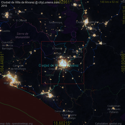
Analysis of Ciudad de Villa de Álvarez night lights 2016
Square area 10x10 km:
 28.35%
90-99
21%80-89
10.82%70-79
11.47%60-69
6.71%50-59
4.33%40-49
3.9%30-39
6.06%20-29
7.14%10-19
0.22%0-9
0%Square area 50x50 km:
1.13%90-99
0.89%80-89
1.05%70-79
1.42%60-69
0.97%50-59
0.69%40-49
1.17%30-39
1.58%20-29
2.04%10-19
4.28%0-9
84.79%Clear (daylight) street map image can be seen on geolist.org.
Map coordinates:
19° 55' 46.6" North, 104° 26' 27.3" West
19° 16' 2" North, 103° 44' 16" West
18° 36' 7.7" North, 103° 2' 4.8" West
Some cities around Ciudad de Villa de Álvarez sort by population:
• Colima
2.2 km =1.4 mi,  149°
149°
• Coquimatlán
10.1 km =6.3 mi,  228°
228°
• Comala
7 km =4.3 mi,  341°
341°
• Quesería
21.9 km =13.6 mi,  52°
52°
• Cuauhtémoc
15.7 km =9.8 mi,  64°
64°
• Pihuamo
37.3 km =23.2 mi,  92°
92°
• Cofradía
27 km =16.8 mi, 46°
• Cofradía de Juárez
40.9 km =25.4 mi,  214°
214°
3980194 (p: 117,600)
Sources (retrieved 2019-11-25):
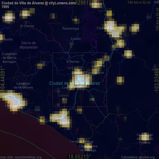
» NASA, Earths city lights 1995
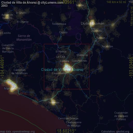
» NASA city lights 2003
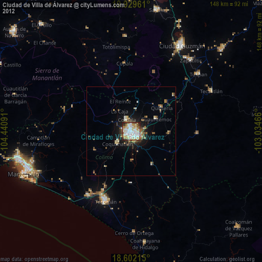
» Earth at Night: Flat Maps 2012, 2016