Ciudad Benito Juárez night lights from space
Night Light of Ciudad Benito Juárez (Nuevo León) from space (Mexico) Src. Average luminocity for 10x10km area is 73.3201% and for 50x50km: 41.3226%.
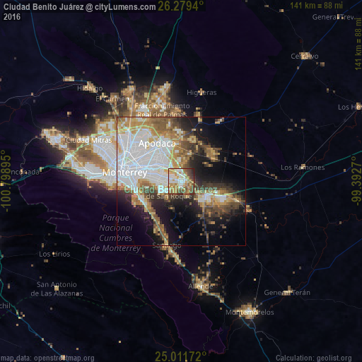
Analysis of Ciudad Benito Juárez night lights 2016
Square area 10x10 km:
 15.53%
90-99
15.91%80-89
9.47%70-79
18.56%60-69
10.61%50-59
12.69%40-49
10.23%30-39
4.55%20-29
2.46%10-19
0%0-9
0%Square area 50x50 km:
11.61%90-99
7.96%80-89
4.48%70-79
5.36%60-69
5.3%50-59
5.33%40-49
5.05%30-39
4.81%20-29
6.12%10-19
11.98%0-9
32%Clear (daylight) street map image can be seen on geolist.org.
Map coordinates:
26° 16' 45.8" North, 100° 47' 56.2" West
25° 38' 50.1" North, 100° 5' 45" West
25° 0' 42.2" North, 99° 23' 33.7" West
Some cities around Ciudad Benito Juárez sort by population:
• Cadereyta Jiménez
11.5 km =7.1 mi,  124°
124°
• Cadereyta
13.3 km =8.3 mi, 122°
• Jardines de la Silla (Jardines)
9.4 km =5.8 mi,  257°
257°
• Misión San Pablo
11.4 km =7.1 mi,  334°
334°
• Héctor Caballero
3.4 km =2.1 mi,  247°
247°
• Monte Kristal
6.6 km =4.1 mi, 249°
• Loma la Paz
8.1 km =5 mi, 331°
• Pesquería
16 km =9.9 mi,  16°
16°
4003757 (p: 151,893)
Sources (retrieved 2019-11-25):
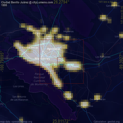
» NASA, Earths city lights 1995
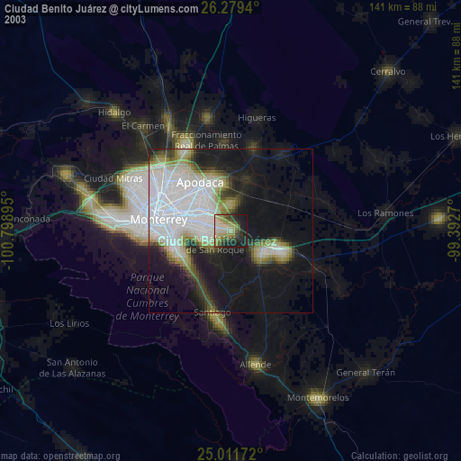
» NASA city lights 2003
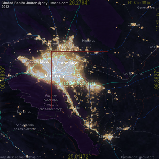
» Earth at Night: Flat Maps 2012, 2016