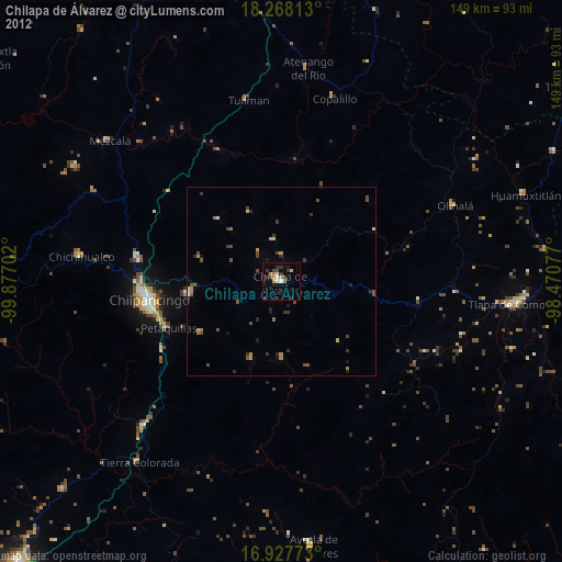
Chilapa de Álvarez night lights from space
Night Light of Chilapa de Álvarez (Guerrero) from space (Mexico) Src. Average luminocity for 10x10km area is 16.9153% and for 50x50km: 2.2151%.
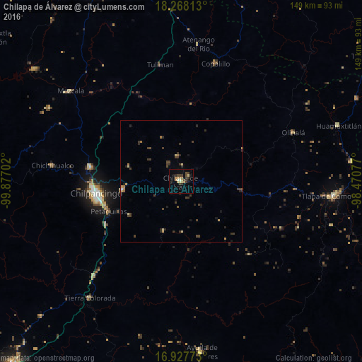
Analysis of Chilapa de Álvarez night lights 2016
Square area 10x10 km:
 0%
0%90-99
1.24%80-89
2.89%70-79
2.48%60-69
3.31%50-59
0.83%40-49
4.96%30-39
3.93%20-29
4.13%10-19
6.4%0-9
69.83%Square area 50x50 km:
0.02%90-99
0.06%80-89
0.35%70-79
0.28%60-69
0.34%50-59
0.13%40-49
0.84%30-39
0.7%20-29
0.84%10-19
0.6%0-9
95.83%Clear (daylight) street map image can be seen on geolist.org.
Map coordinates:
18° 16' 5.3" North, 99° 52' 37.3" West
17° 35' 57" North, 99° 10' 26" West
16° 55' 39.8" North, 98° 28' 14.8" West
Some cities around Chilapa de Álvarez sort by population:
• Chilpancingo
35.6 km =22.1 mi,  261°
261°
• Tixtla de Guerrero
24 km =14.9 mi, 261°
• Petaquillas
32.5 km =20.2 mi,  247°
247°
• Zitlala
10.2 km =6.3 mi,  352°
352°
• Atliaca
22.1 km =13.7 mi,  285°
285°
• Quechultenango
21.8 km =13.5 mi,  199°
199°
• Mazatlán
35.8 km =22.2 mi,  239°
239°
• Mochitlán
25.2 km =15.7 mi, 235°
3530886 (p: 31,157)
Sources (retrieved 2019-11-25):
» Earth at Night: Flat Maps 2012, 2016