Benjamín Hill night lights from space
Night Light of Benjamín Hill (Sonora) from space (Mexico) Src. Average luminocity for 10x10km area is 5.4668% and for 50x50km: 0.4511%.
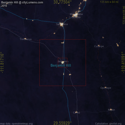
Analysis of Benjamín Hill night lights 2016
Square area 10x10 km:
 0.35%
0.35%90-99
0.35%80-89
0%70-79
3.15%60-69
1.75%50-59
0%40-49
0.7%30-39
0%20-29
0%10-19
0.7%0-9
93.01%Square area 50x50 km:
0.01%90-99
0.01%80-89
0%70-79
0.28%60-69
0.1%50-59
0.04%40-49
0.08%30-39
0.03%20-29
0.03%10-19
0.06%0-9
99.35%Clear (daylight) street map image can be seen on geolist.org.
Map coordinates:
30° 46' 30.1" North, 111° 49' 1.8" West
30° 10' 8.5" North, 111° 6' 50.5" West
29° 33' 33.4" North, 110° 24' 39.3" West
Some cities around Benjamín Hill sort by population:
• Hermosillo
119.3 km =74.1 mi,  173°
173°
• Heroica Caborca
117.3 km =72.9 mi,  301°
301°
• Magdalena de Kino
53.1 km =33 mi,  15°
15°
• Santa Ana
41.3 km =25.7 mi,  359°
359°
• Altar
92.2 km =57.3 mi,  311°
311°
• Imuris
73.6 km =45.7 mi, 20°
• Pesqueira
90.2 km =56 mi, 166°
• Pitiquito
106.4 km =66.1 mi, 302°
4017152 (p: 5,071)
Sources (retrieved 2019-11-25):
» Earth at Night: Flat Maps 2012, 2016