Atlixco night lights from space
Night Light of Atlixco (Puebla) from space (Mexico) Src. Average luminocity for 10x10km area is 66.9697% and for 50x50km: 27.1795%.
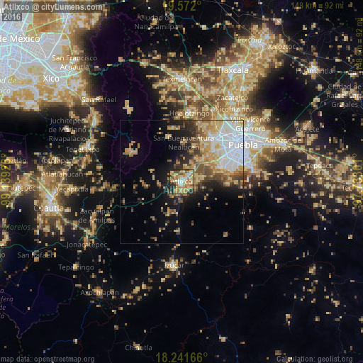
Analysis of Atlixco night lights 2016
Square area 10x10 km:
 4.98%
4.98%90-99
6.71%80-89
25.11%70-79
13.64%60-69
23.16%50-59
2.6%40-49
6.28%30-39
6.06%20-29
11.26%10-19
0.22%0-9
0%Square area 50x50 km:
6.19%90-99
3.14%80-89
5.54%70-79
4.3%60-69
4.09%50-59
2.71%40-49
3.6%30-39
2.68%20-29
4.12%10-19
8.35%0-9
55.27%Clear (daylight) street map image can be seen on geolist.org.
Map coordinates:
19° 34' 19.2" North, 99° 8' 21.3" West
18° 54' 29.3" North, 98° 26' 10.1" West
18° 14' 30" North, 97° 43' 58.8" West
Some cities around Atlixco sort by population:
• San Bernardino Tlaxcalancingo
21.4 km =13.3 mi,  51°
51°
• Nealtican
15.8 km =9.8 mi,  3°
3°
• San Andrés Azumiatla
19.3 km =12 mi,  91°
91°
• Zacapechpan
18.6 km =11.6 mi,  28°
28°
• San Jerónimo Coyula
8.6 km =5.3 mi,  259°
259°
• San Nicolás de los Ranchos
18.9 km =11.7 mi,  343°
343°
• Tianguismanalco
7.7 km =4.8 mi,  350°
350°
• Chalchihuapan
12.6 km =7.8 mi,  55°
55°
3532592 (p: 86,690)
Sources (retrieved 2019-11-25):
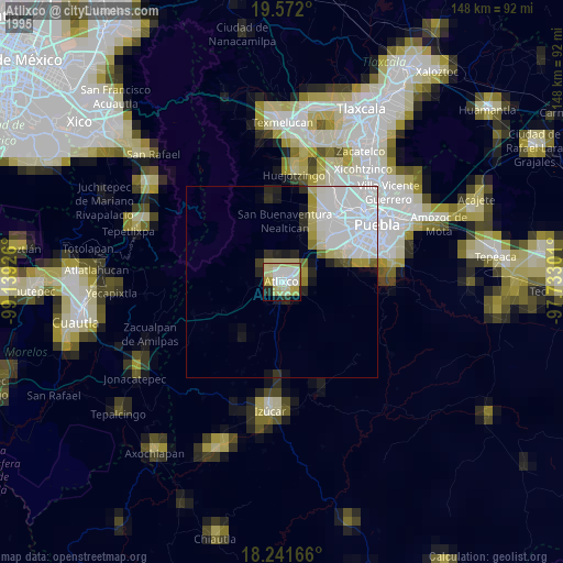
» NASA, Earths city lights 1995
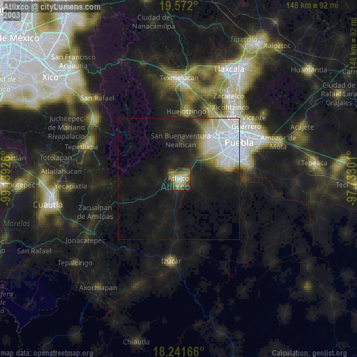
» NASA city lights 2003
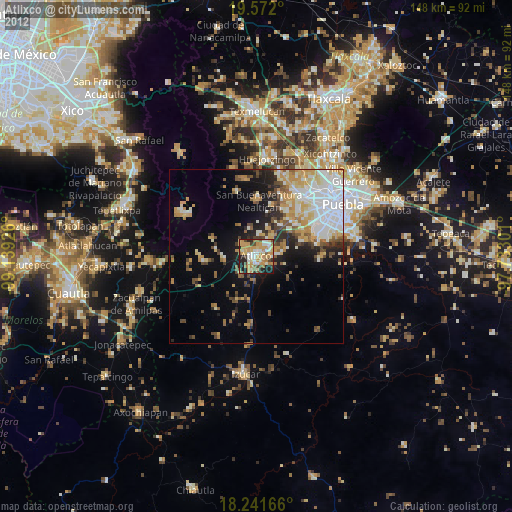
» Earth at Night: Flat Maps 2012, 2016