Álvaro Obregón night lights from space
Night Light of Álvaro Obregón (Mexico City) from space (Mexico) Src. Average luminocity for 10x10km area is 99.9917% and for 50x50km: 69.7339%.
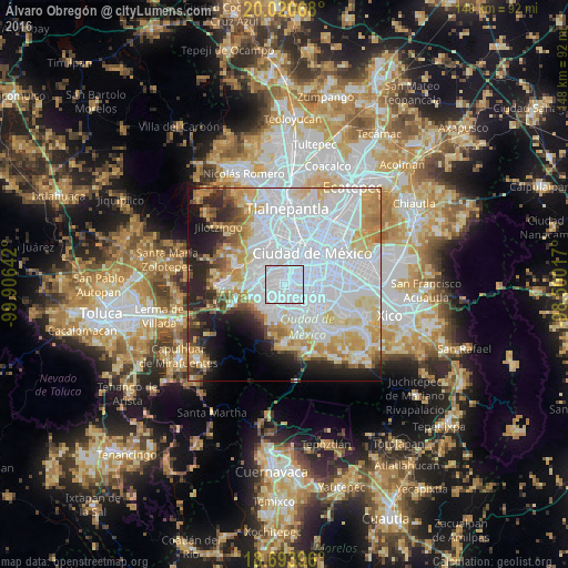
Analysis of Álvaro Obregón night lights 2016
Square area 10x10 km:
 99.17%
90-99
0.83%80-89
0%70-79
0%60-69
0%50-59
0%40-49
0%30-39
0%20-29
0%10-19
0%0-9
0%Square area 50x50 km:
36.36%90-99
10.32%80-89
9.11%70-79
7.37%60-69
4.78%50-59
2.78%40-49
3.31%30-39
3.09%20-29
6.94%10-19
7.38%0-9
8.54%Clear (daylight) street map image can be seen on geolist.org.
Map coordinates:
20° 1' 14.4" North, 99° 54' 23.1" West
19° 21' 31.2" North, 99° 12' 11.8" West
18° 41' 38.3" North, 98° 30' 0.6" West
Some cities around Álvaro Obregón sort by population:
• Coyoacán
4.6 km =2.9 mi,  106°
106°
• Benito Juárez
5.2 km =3.2 mi,  72°
72°
• Benito Juarez
6.5 km =4 mi,  47°
47°
• Colonia del Valle
5.3 km =3.3 mi, 54°
• Magdalena Contreras
3.1 km =1.9 mi,  195°
195°
• Colonia Nativitas
7.4 km =4.6 mi, 70°
• Polanco
8.3 km =5.2 mi,  2°
2°
• Col. Bosques de las Lomas
6.9 km =4.3 mi,  288°
288°
3514663 (p: 726,664)
Sources (retrieved 2019-11-25):
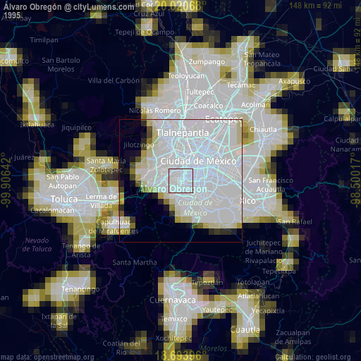
» NASA, Earths city lights 1995
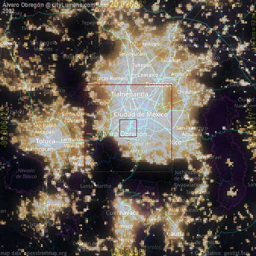
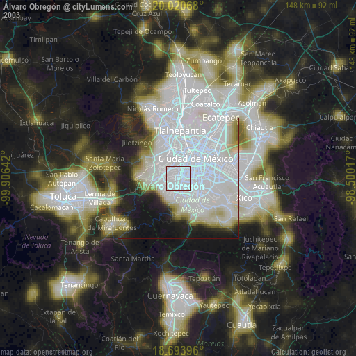
» NASA city lights 2003
» Earth at Night: Flat Maps 2012, 2016