Lalmatie night lights from space
Night Light of Lalmatie (Flacq) from space (Mauritius) Src. Average luminocity for 10x10km area is 9.5893% and for 50x50km: 16.4905%.
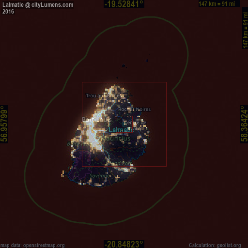
Analysis of Lalmatie night lights 2016
Square area 10x10 km:
 0%
0%90-99
0%80-89
0.79%70-79
0.6%60-69
0.79%50-59
0.99%40-49
0.4%30-39
6.15%20-29
4.37%10-19
1.79%0-9
84.13%Square area 50x50 km:
1.62%90-99
2.91%80-89
2.01%70-79
1.61%60-69
1.87%50-59
2.16%40-49
3.73%30-39
3.88%20-29
5.62%10-19
8.18%0-9
66.41%Clear (daylight) street map image can be seen on geolist.org.
Map coordinates:
19° 31' 42.3" South, 56° 57' 28.8" East
20° 11' 23" South, 57° 39' 40" East
20° 50' 53.6" South, 58° 21' 51.3" East
Some cities around Lalmatie sort by population:
• Centre de Flacq
5.6 km =3.5 mi,  90°
90°
• Rivière du Rempart
9.9 km =6.2 mi,  14°
14°
• Brisée Verdière
3.2 km =2 mi,  332°
332°
• Poste de Flacq
7.8 km =4.8 mi,  67°
67°
• Bon Accueil
2.2 km =1.4 mi,  346°
346°
• Quartier Militaire
9.3 km =5.8 mi,  225°
225°
• Laventure
5.1 km =3.2 mi,  18°
18°
• Ecroignard
8.8 km =5.5 mi,  117°
117°
934390 (p: 10,404)
Sources (retrieved 2019-11-25):
» Earth at Night: Flat Maps 2012, 2016