Grand Baie night lights from space
Night Light of Grand Baie (Rivière du Rempart) from space (Mauritius) Src. Average luminocity for 10x10km area is 36.4583% and for 50x50km: 11.1801%.
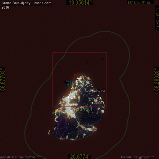
Analysis of Grand Baie night lights 2016
Square area 10x10 km:
 1.19%
1.19%90-99
5.75%80-89
6.15%70-79
5.75%60-69
4.96%50-59
4.76%40-49
6.94%30-39
8.13%20-29
17.66%10-19
26.39%0-9
12.3%Square area 50x50 km:
1.03%90-99
1.78%80-89
1.39%70-79
1.31%60-69
1.24%50-59
1.29%40-49
2.52%30-39
2.77%20-29
4%10-19
6.18%0-9
76.48%Clear (daylight) street map image can be seen on geolist.org.
Map coordinates:
19° 21' 22.1" South, 56° 52' 37.3" East
20° 1' 5.4" South, 57° 34' 48.5" East
20° 40' 38.6" South, 58° 16' 59.8" East
Some cities around Grand Baie sort by population:
• Triolet
5.4 km =3.4 mi,  215°
215°
• Goodlands
7.7 km =4.8 mi,  107°
107°
• Petit Raffray
4.5 km =2.8 mi,  92°
92°
• Plaine des Papayes
5.3 km =3.3 mi,  188°
188°
• Pointe aux Piments
7.9 km =4.9 mi,  228°
228°
• Morcellement Saint André
6.1 km =3.8 mi, 191°
• Piton
9.6 km =6 mi,  146°
146°
• Fond du Sac
3.3 km =2.1 mi,  172°
172°
934482 (p: 11,512)
Sources (retrieved 2019-11-25):
» Earth at Night: Flat Maps 2012, 2016