San Pawl il-Baħar night lights from space
Night Light of San Pawl il-Baħar (Saint Paul’s Bay) from space (Malta) Src. Average luminocity for 10x10km area is 45.4066% and for 50x50km: 10.4208%.
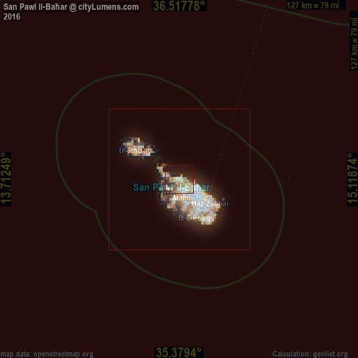
Analysis of San Pawl il-Baħar night lights 2016
Square area 10x10 km:
 5.31%
5.31%90-99
6.23%80-89
6.59%70-79
9.71%60-69
12.64%50-59
2.56%40-49
6.23%30-39
5.13%20-29
14.65%10-19
22.89%0-9
8.06%Square area 50x50 km:
1.79%90-99
2%80-89
1.14%70-79
1.4%60-69
1.94%50-59
0.68%40-49
1.13%30-39
1.39%20-29
2.55%10-19
5.98%0-9
80.02%Clear (daylight) street map image can be seen on geolist.org.
Map coordinates:
36° 31' 4" North, 13° 42' 45" East
35° 57' 2.3" North, 14° 24' 56.2" East
35° 22' 45.8" North, 15° 7' 7.5" East
Some cities around San Pawl il-Baħar sort by population:
• Mosta
4.7 km =2.9 mi,  169°
169°
• Naxxar
4.8 km =3 mi,  148°
148°
• Mellieħa
4.8 km =3 mi,  277°
277°
• L-Iklin
6.2 km =3.9 mi, 146°
• Pembroke
5.9 km =3.7 mi,  112°
112°
• Imġarr
5.6 km =3.5 mi,  232°
232°
• Lija
6.2 km =3.9 mi, 153°
• Hal Gharghur
4.4 km =2.7 mi,  132°
132°
2562541 (p: 14,057)
Sources (retrieved 2019-11-25):
» Earth at Night: Flat Maps 2012, 2016