Munxar night lights from space
Night Light of Munxar (Il-Munxar) from space (Malta) Src. Average luminocity for 10x10km area is 27.7436% and for 50x50km: 7.974%.
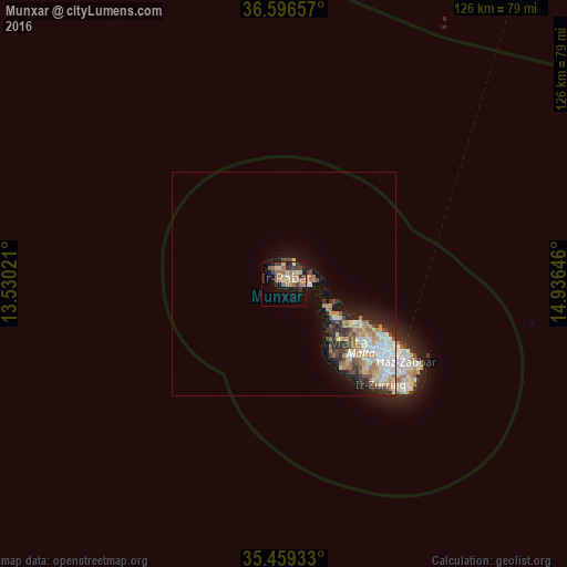
Analysis of Munxar night lights 2016
Square area 10x10 km:
100  0.92%
0.92%
90-99 1.65%
80-89 6.04%
70-79 3.85%
60-69 8.97%
50-59 4.76%
40-49 3.11%
30-39 6.41%
20-29 2.38%
10-19 19.78%
0-9 42.12%
0.92%90-99
1.65%80-89
6.04%70-79
3.85%60-69
8.97%50-59
4.76%40-49
3.11%30-39
6.41%20-29
2.38%10-19
19.78%0-9
42.12%Square area 50x50 km:
100 1.34%
90-99 1.44%
80-89 0.84%
70-79 1.14%
60-69 1.69%
50-59 0.59%
40-49 1.05%
30-39 1.15%
20-29 1.66%
10-19 3.84%
0-9 85.26%
1.34%90-99
1.44%80-89
0.84%70-79
1.14%60-69
1.69%50-59
0.59%40-49
1.05%30-39
1.15%20-29
1.66%10-19
3.84%0-9
85.26%Clear (daylight) street map image can be seen on geolist.org.
Map coordinates:
36° 35' 47.7" North, 13° 31' 48.8" East
36° 1' 48" North, 14° 13' 60" East
35° 27' 33.6" North, 14° 56' 11.3" East
Some cities around Munxar sort by population:
• Victoria
1.7 km =1.1 mi,  19°
19°
• Xagħra
3.6 km =2.2 mi,  51°
51°
• Xewkija
2.2 km =1.4 mi,  82°
82°
• Saint Lucia
2.1 km =1.3 mi,  315°
315°
• Sannat
1.1 km =0.7 mi,  126°
126°
• Kerċem
1.5 km =0.9 mi,  335°
335°
• Fontana
0.9 km =0.6 mi, 16°
• San Lawrenz
3.9 km =2.4 mi, 316°
2562693 (p: 840)
Sources (retrieved 2019-11-25):
» Earth at Night: Flat Maps 2012, 2016