Myaydo night lights from space
Night Light of Myaydo (Magway) from space (Myanmar) Src. Average luminocity for 10x10km area is 11.655% and for 50x50km: 0.6278%.
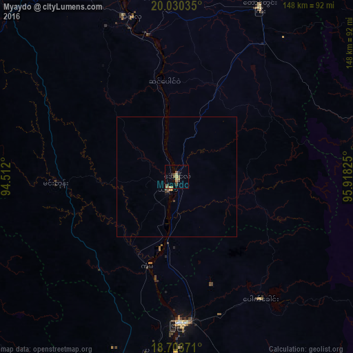
Analysis of Myaydo night lights 2016
Square area 10x10 km:
 0%
0%90-99
0%80-89
2.89%70-79
2.07%60-69
2.07%50-59
1.45%40-49
5.58%30-39
1.65%20-29
1.24%10-19
0.62%0-9
82.44%Square area 50x50 km:
0%90-99
0%80-89
0.11%70-79
0.15%60-69
0.08%50-59
0.06%40-49
0.32%30-39
0.13%20-29
0.05%10-19
0.06%0-9
99.05%Clear (daylight) street map image can be seen on geolist.org.
Map coordinates:
20° 1' 49.3" North, 94° 30' 43.2" East
19° 22' 6.2" North, 95° 12' 54.4" East
18° 42' 13.4" North, 95° 55' 5.7" East
Some cities around Myaydo sort by population:
• Nay Pyi Taw
104.6 km =65 mi,  66°
66°
• Pyay
60.5 km =37.6 mi,  179°
179°
• Thayetmyo
6.3 km =3.9 mi,  212°
212°
• Pyinmana
111.8 km =69.5 mi, 68°
• Magway
91.8 km =57 mi,  341°
341°
• Taungdwingyi
78.9 km =49 mi,  25°
25°
• Minbu
97 km =60.3 mi, 338°
• Paungde
102.2 km =63.5 mi,  162°
162°
1329239 (p: 57,897)
Sources (retrieved 2019-11-25):
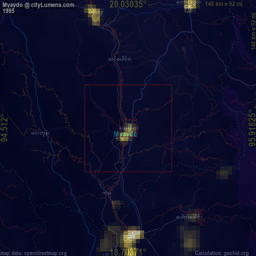
» NASA, Earths city lights 1995
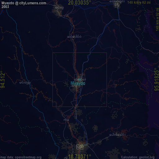
» NASA city lights 2003
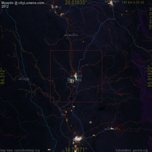
» Earth at Night: Flat Maps 2012, 2016