Mawlamyinegyunn night lights from space
Night Light of Mawlamyinegyunn (Ayeyarwady) from space (Myanmar) Src. Average luminocity for 10x10km area is 0.9442% and for 50x50km: 0.156%.
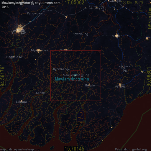
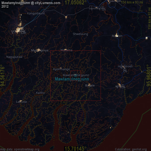
Analysis of Mawlamyinegyunn night lights 2016
Square area 10x10 km:
 0%
0%90-99
0%80-89
0%70-79
0%60-69
0%50-59
0%40-49
0.83%30-39
0.41%20-29
0.83%10-19
1.24%0-9
96.69%Square area 50x50 km:
0%90-99
0%80-89
0%70-79
0%60-69
0%50-59
0.07%40-49
0.08%30-39
0.11%20-29
0.07%10-19
0.05%0-9
99.62%Clear (daylight) street map image can be seen on geolist.org.
Map coordinates:
17° 3' 2.2" North, 94° 33' 42.3" East
16° 22' 37.9" North, 95° 15' 53.6" East
15° 42' 5.2" North, 95° 58' 4.8" East
Some cities around Mawlamyinegyunn sort by population:
• Pathein
72.3 km =44.9 mi,  308°
308°
• Bogale
16.9 km =10.5 mi,  123°
123°
• Pyapon
45.3 km =28.1 mi,  103°
103°
• Kyaiklat
49.5 km =30.8 mi,  81°
81°
• Maubin
57.2 km =35.5 mi,  46°
46°
• Twante
79.9 km =49.6 mi,  62°
62°
• Wakema
26.6 km =16.5 mi,  340°
340°
• Nyaungdon
84.3 km =52.4 mi,  28°
28°
1308464 (p: 39,115)
Sources (retrieved 2019-11-25):
» Earth at Night: Flat Maps 2012, 2016