Krivogashtani night lights from space
Night Light of Krivogashtani from space (North Macedonia) Src. Average luminocity for 10x10km area is 0.4065% and for 50x50km: 1.2815%.
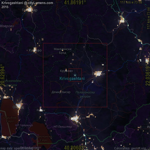
Analysis of Krivogashtani night lights 2016
Square area 10x10 km:
 0%
0%90-99
0%80-89
0%70-79
0%60-69
0%50-59
0%40-49
0.68%30-39
0%20-29
0%10-19
0%0-9
99.32%Square area 50x50 km:
0.13%90-99
0.31%80-89
0.16%70-79
0.16%60-69
0.1%50-59
0.05%40-49
0.14%30-39
0.1%20-29
0.19%10-19
1.12%0-9
97.53%Clear (daylight) street map image can be seen on geolist.org.
Map coordinates:
41° 51' 42.9" North, 20° 37' 47.8" East
41° 20' 10" North, 21° 19' 59" East
40° 48' 21.7" North, 22° 2' 10.3" East
Some cities around Krivogashtani sort by population:
• Bitola
33.9 km =21.1 mi,  179°
179°
• Prilep
18.6 km =11.6 mi,  86°
86°
• Dolneni
14.2 km =8.8 mi,  45°
45°
• Makedonski Brod
22 km =13.7 mi,  333°
333°
• Krusevo
7.9 km =4.9 mi,  297°
297°
• Plasnica
22.8 km =14.2 mi,  309°
309°
• Mogila
25.6 km =15.9 mi,  171°
171°
• Demir Hisar
16.8 km =10.4 mi,  220°
220°
789028 (p: 5,899)
Sources (retrieved 2019-11-25):
» Earth at Night: Flat Maps 2012, 2016