Debar night lights from space
Night Light of Debar from space (North Macedonia) Src. Average luminocity for 10x10km area is 2.9949% and for 50x50km: 0.2761%.
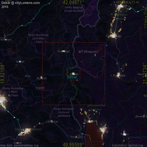
Analysis of Debar night lights 2016
Square area 10x10 km:
 0%
0%90-99
0%80-89
1.19%70-79
1.53%60-69
0%50-59
0%40-49
0.68%30-39
0%20-29
0.68%10-19
0%0-9
95.92%Square area 50x50 km:
0%90-99
0.06%80-89
0.04%70-79
0.06%60-69
0.03%50-59
0.03%40-49
0.1%30-39
0%20-29
0.08%10-19
0.06%0-9
99.54%Clear (daylight) street map image can be seen on geolist.org.
Map coordinates:
42° 2' 55.4" North, 19° 49' 15.9" East
41° 31' 28" North, 20° 31' 27.2" East
40° 59' 45.2" North, 21° 13' 38.4" East
Some cities around Debar sort by population:
• Centar Župa
5.9 km =3.7 mi,  150°
150°
• Peshkopi, AL
19.5 km =12.1 mi,  336°
336°
• Bulqizë, AL
25.4 km =15.8 mi,  261°
261°
• Rostusa
11.4 km =7.1 mi,  33°
33°
• Labunista
29.1 km =18.1 mi,  168°
168°
• Velesta
33.1 km =20.6 mi,  162°
162°
• Delogožda
34 km =21.1 mi, 150°
• Vevčani
32.1 km =19.9 mi, 169°
791606 (p: 18,074)
Sources (retrieved 2019-11-25):
» Earth at Night: Flat Maps 2012, 2016