Kolašin night lights from space
Night Light of Kolašin (Opština Kolašin) from space (Montenegro) Src. Average luminocity for 10x10km area is 1.8561% and for 50x50km: 0.4955%.
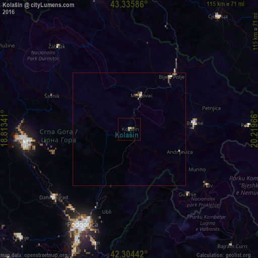
Analysis of Kolašin night lights 2016
Square area 10x10 km:
 0%
0%90-99
0%80-89
0%70-79
1.21%60-69
0%50-59
0.45%40-49
0.61%30-39
0.76%20-29
0%10-19
0.61%0-9
96.36%Square area 50x50 km:
0.04%90-99
0.06%80-89
0.05%70-79
0.08%60-69
0.08%50-59
0.07%40-49
0.23%30-39
0.06%20-29
0.06%10-19
0.03%0-9
99.25%Clear (daylight) street map image can be seen on geolist.org.
Map coordinates:
43° 20' 9.1" North, 18° 48' 48.3" East
42° 49' 20.2" North, 19° 30' 59.5" East
42° 18' 15.9" North, 20° 13' 10.8" East
Some cities around Kolašin sort by population:
• Bijelo Polje
30.5 km =19 mi,  38°
38°
• Berane
29.2 km =18.1 mi,  85°
85°
• Danilovgrad
42.5 km =26.4 mi,  225°
225°
• Mojkovac
16.3 km =10.1 mi,  19°
19°
• Andrijevica
24.5 km =15.2 mi,  113°
113°
• Šavnik
37.3 km =23.2 mi,  293°
293°
• Gusinje
38.9 km =24.2 mi,  138°
138°
• Petnjica
37.8 km =23.5 mi,  75°
75°
3197896 (p: 2,989)
Sources (retrieved 2019-11-25):
» Earth at Night: Flat Maps 2012, 2016