Al Ajaylat night lights from space
Night Light of Al Ajaylat (An Nuqāţ al Khams) from space (Libya) Src. Average luminocity for 10x10km area is 53.2657% and for 50x50km: 17.2896%.
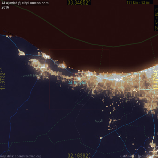
Analysis of Al Ajaylat night lights 2016
Square area 10x10 km:
 1.75%
1.75%90-99
3.67%80-89
9.44%70-79
13.29%60-69
14.69%50-59
7.34%40-49
11.89%30-39
23.6%20-29
11.19%10-19
3.15%0-9
0%Square area 50x50 km:
1.23%90-99
1.49%80-89
2.47%70-79
3.52%60-69
3.14%50-59
2.23%40-49
3.92%30-39
4.29%20-29
4.69%10-19
11.31%0-9
61.7%Clear (daylight) street map image can be seen on geolist.org.
Map coordinates:
33° 20' 47.5" North, 11° 40' 23.6" East
32° 45' 25.8" North, 12° 22' 34.8" East
32° 9' 50.1" North, 13° 4' 46.1" East
Some cities around Al Ajaylat sort by population:
• Tripoli
77.2 km =48 mi,  79°
79°
• Az Zāwīyah
32.9 km =20.4 mi,  90°
90°
• Zawiya
32.9 km =20.4 mi, 90°
• Şabrātah
11.2 km =7 mi,  69°
69°
• Zuwārah
33.6 km =20.9 mi,  305°
305°
• Şurmān
18.3 km =11.4 mi, 90°
• Zalţan
52.1 km =32.4 mi,  293°
293°
• Al ‘Azīzīyah
65 km =40.4 mi,  112°
112°
2219701 (p: 130,546)
Sources (retrieved 2019-11-25):
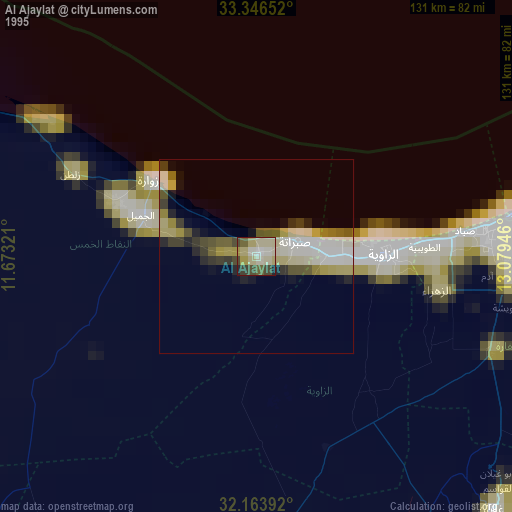
» NASA, Earths city lights 1995
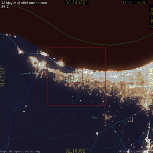
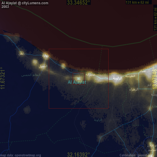
» NASA city lights 2003
» Earth at Night: Flat Maps 2012, 2016