Luxembourg night lights from space
Night Light of Luxembourg from space (Luxembourg) Src. Average luminocity for 10x10km area is 70.9818% and for 50x50km: 19.7276%.
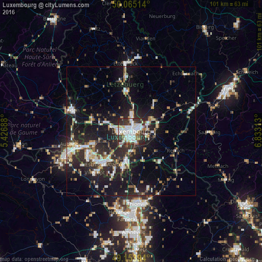
Analysis of Luxembourg night lights 2016
Square area 10x10 km:
 25.21%
90-99
23.53%80-89
5.6%70-79
2.1%60-69
2.94%50-59
6.72%40-49
3.92%30-39
18.35%20-29
11.48%10-19
0.14%0-9
0%Square area 50x50 km:
3.39%90-99
3.54%80-89
1.85%70-79
1.61%60-69
1.69%50-59
2.11%40-49
2.44%30-39
3.41%20-29
8.65%10-19
16.44%0-9
54.88%Clear (daylight) street map image can be seen on geolist.org.
Map coordinates:
50° 3' 54.5" North, 5° 25' 36.8" East
49° 36' 42" North, 6° 7' 48" East
49° 9' 14.2" North, 6° 49' 59.3" East
Some cities around Luxembourg sort by population:
• Esch-sur-Alzette
16.8 km =10.4 mi,  219°
219°
• Dudelange
14.9 km =9.3 mi,  191°
191°
• Schifflange
14.4 km =8.9 mi, 215°
• Bettembourg
10.5 km =6.5 mi, 190°
• Strassen
4.2 km =2.6 mi,  283°
283°
• Bertrange
5.8 km =3.6 mi,  269°
269°
• Mamer
7.9 km =4.9 mi, 282°
• Mersch
15.4 km =9.6 mi,  353°
353°
2960316 (p: 76,684)
Sources (retrieved 2019-11-25):
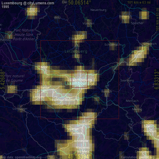
» NASA, Earths city lights 1995
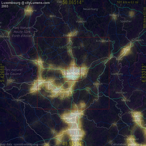
» NASA city lights 2003
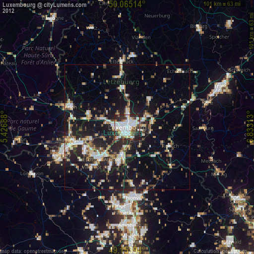
» Earth at Night: Flat Maps 2012, 2016