Temirtau night lights from space
Night Light of Temirtau (Karaganda) from space (Kazakhstan) Src. Average luminocity for 10x10km area is 49.2479% and for 50x50km: 5.9934%.
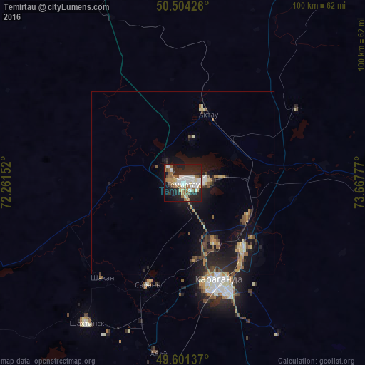
Analysis of Temirtau night lights 2016
Square area 10x10 km:
 11.76%
90-99
10.78%80-89
4.9%70-79
3.22%60-69
8.54%50-59
7.28%40-49
2.38%30-39
1.96%20-29
24.37%10-19
21.15%0-9
3.64%Square area 50x50 km:
0.59%90-99
0.62%80-89
0.7%70-79
0.72%60-69
0.82%50-59
0.93%40-49
0.94%30-39
0.63%20-29
2.51%10-19
5.74%0-9
85.79%Clear (daylight) street map image can be seen on geolist.org.
Map coordinates:
50° 30' 15.3" North, 72° 15' 41.5" East
50° 3' 17.8" North, 72° 57' 52.7" East
49° 36' 4.9" North, 73° 40' 4" East
Some cities around Temirtau sort by population:
• Karagandy
29.8 km =18.5 mi,  160°
160°
• Soran
30.7 km =19.1 mi,  197°
197°
• Shakhtinsk
46.8 km =29.1 mi,  214°
214°
• Abay
47.2 km =29.3 mi,  189°
189°
• Shakhan
34.3 km =21.3 mi,  220°
220°
• Aktas
30.6 km =19 mi,  180°
180°
• Aktau
21.3 km =13.2 mi,  19°
19°
• Novodolinskiy
42.9 km =26.7 mi, 205°
1518262 (p: 170,600)
Sources (retrieved 2019-11-25):
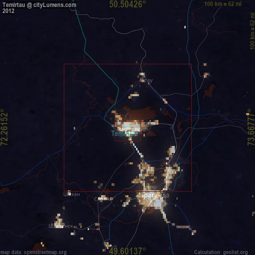
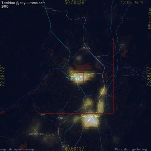
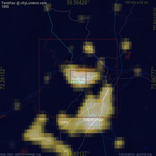
» NASA, Earths city lights 1995
» NASA city lights 2003
» Earth at Night: Flat Maps 2012, 2016