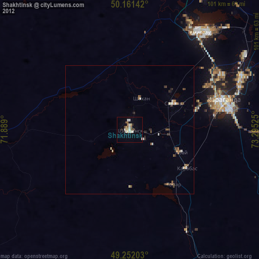
Shakhtinsk night lights from space
Night Light of Shakhtinsk (Karaganda) from space (Kazakhstan) Src. Average luminocity for 10x10km area is 10.3623% and for 50x50km: 1.0375%.
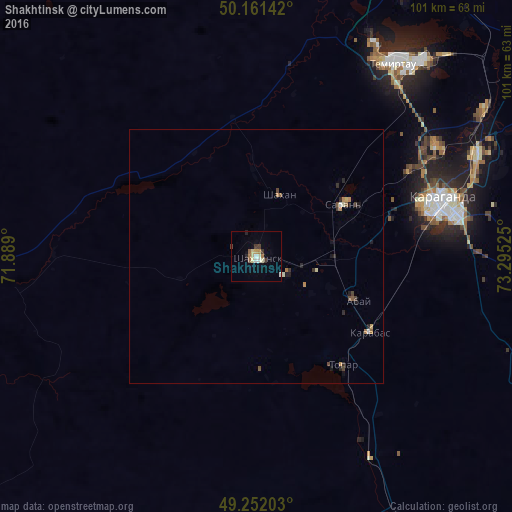
Analysis of Shakhtinsk night lights 2016
Square area 10x10 km:
 1.2%
1.2%90-99
2.14%80-89
1.6%70-79
0.8%60-69
1.2%50-59
1.07%40-49
1.34%30-39
1.34%20-29
1.07%10-19
0.53%0-9
87.7%Square area 50x50 km:
0.07%90-99
0.17%80-89
0.12%70-79
0.13%60-69
0.16%50-59
0.14%40-49
0.23%30-39
0.13%20-29
0.26%10-19
0.24%0-9
98.37%Clear (daylight) street map image can be seen on geolist.org.
Map coordinates:
50° 9' 41.1" North, 71° 53' 20.4" East
49° 42' 31.9" North, 72° 35' 31.6" East
49° 15' 7.3" North, 73° 17' 42.9" East
Some cities around Shakhtinsk sort by population:
• Karagandy
38.1 km =23.7 mi,  74°
74°
• Temirtau
46.8 km =29.1 mi,  34°
34°
• Soran
19.8 km =12.3 mi,  62°
62°
• Abay
21 km =13 mi,  112°
112°
• Aktas
27.7 km =17.2 mi, 73°
• Aktau
67.6 km =42 mi, 30°
• Osakarovka
94.9 km =59 mi,  359°
359°
• Novodolinskiy
8.3 km =5.2 mi,  91°
91°
1519327 (p: 41,602)
Sources (retrieved 2019-11-25):
» Earth at Night: Flat Maps 2012, 2016