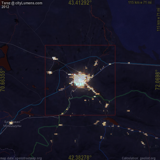
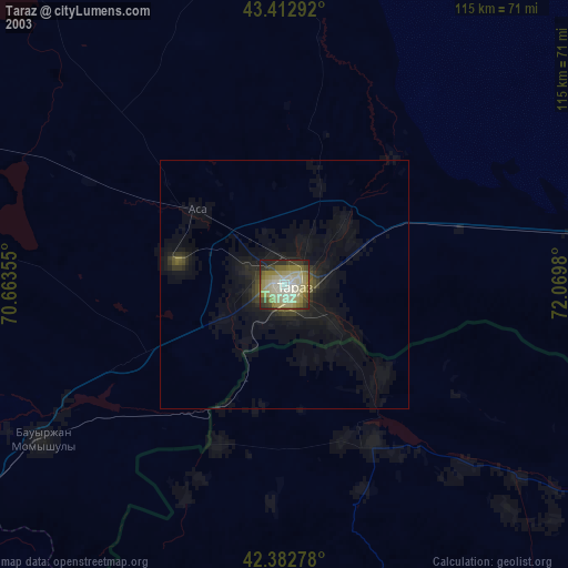
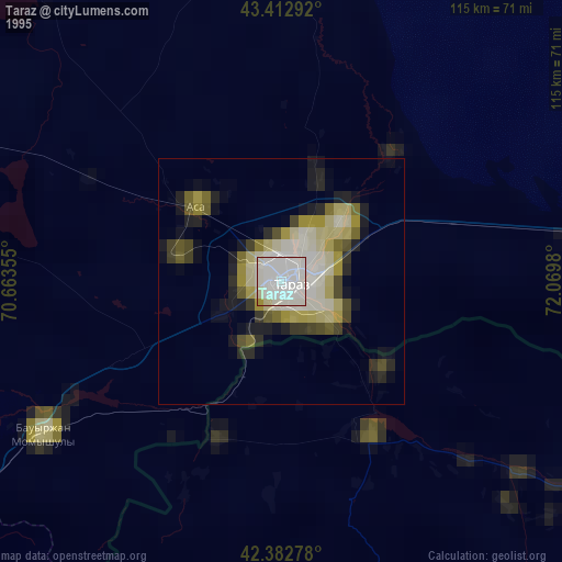
Taraz night lights from space
Night Light of Taraz (Zhambyl) from space (Kazakhstan) Src. Average luminocity for 10x10km area is 74.781% and for 50x50km: 5.3443%.
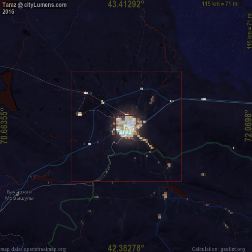
Analysis of Taraz night lights 2016
Square area 10x10 km:
 22.86%
90-99
26.83%80-89
8.41%70-79
7.46%60-69
4.92%50-59
5.71%40-49
3.65%30-39
7.46%20-29
10.48%10-19
2.22%0-9
0%Square area 50x50 km:
1.01%90-99
1.29%80-89
0.52%70-79
0.55%60-69
0.4%50-59
0.47%40-49
0.39%30-39
0.87%20-29
1.78%10-19
3.17%0-9
89.56%Clear (daylight) street map image can be seen on geolist.org.
Map coordinates:
43° 24' 46.5" North, 70° 39' 48.8" East
42° 54' 0" North, 71° 22' 0" East
42° 22' 58" North, 72° 4' 11.3" East
Some cities around Taraz sort by population:
• Karatau
79.4 km =49.3 mi,  292°
292°
• Talas, KG
83 km =51.6 mi,  120°
120°
• Turar Ryskulov
92.5 km =57.5 mi,  243°
243°
• Sarykemer
15.5 km =9.6 mi,  44°
44°
• Lugovoye
110.3 km =68.5 mi,  89°
89°
• Tyul’kubas
98.9 km =61.5 mi, 242°
• Lugovoy
113.6 km =70.6 mi, 87°
• Sastobe
118.2 km =73.4 mi,  250°
250°
1516905 (p: 358,153)
Sources (retrieved 2019-11-25):
» NASA, Earths city lights 1995
» NASA city lights 2003
» Earth at Night: Flat Maps 2012, 2016