Sarykemer night lights from space
Night Light of Sarykemer (Zhambyl) from space (Kazakhstan) Src. Average luminocity for 10x10km area is 1.8349% and for 50x50km: 4.9309%.
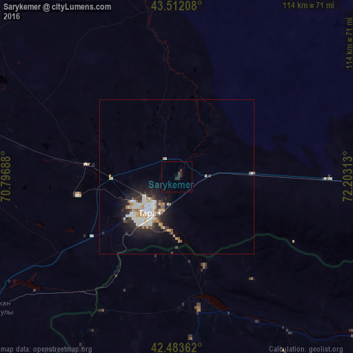
Analysis of Sarykemer night lights 2016
Square area 10x10 km:
 0%
0%90-99
0%80-89
0%70-79
0%60-69
0%50-59
0%40-49
0.63%30-39
1.59%20-29
2.22%10-19
0%0-9
95.56%Square area 50x50 km:
0.97%90-99
1.21%80-89
0.45%70-79
0.5%60-69
0.39%50-59
0.39%40-49
0.37%30-39
0.74%20-29
1.61%10-19
3.11%0-9
90.26%Clear (daylight) street map image can be seen on geolist.org.
Map coordinates:
43° 30' 43.5" North, 70° 47' 48.8" East
43° 0' 0" North, 71° 30' 0" East
42° 29' 1" North, 72° 12' 11.3" East
Some cities around Sarykemer sort by population:
• Taraz
15.5 km =9.6 mi,  224°
224°
• Karatau
86.1 km =53.5 mi,  283°
283°
• Talas, KG
80.6 km =50.1 mi,  131°
131°
• Turar Ryskulov
107.3 km =66.7 mi,  241°
241°
• Lugovoye
99.8 km =62 mi,  95°
95°
• Tyul’kubas
113.7 km =70.6 mi, 239°
• Lugovoy
102.8 km =63.9 mi,  93°
93°
• Sastobe
132.2 km =82.1 mi,  247°
247°
1520947 (p: 15,132)
Sources (retrieved 2019-11-25):
» Earth at Night: Flat Maps 2012, 2016