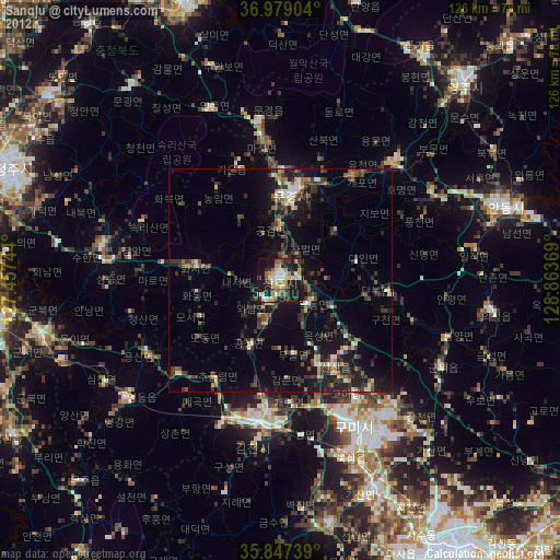
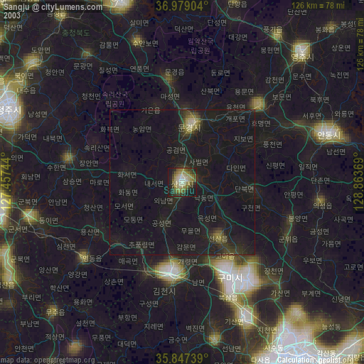
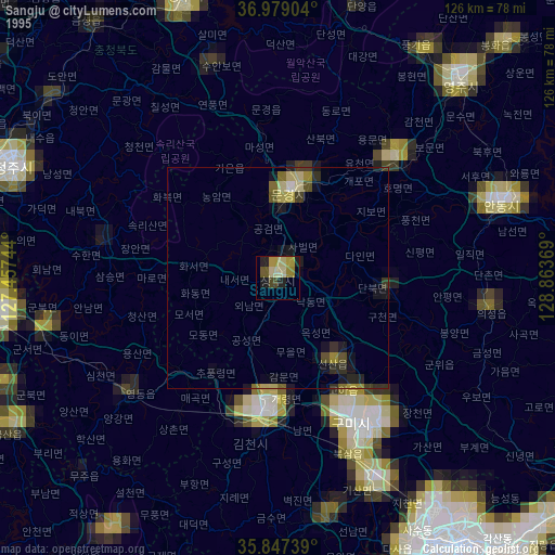
Sangju night lights from space
Night Light of Sangju (Gyeongsangbuk-do) from space (South Korea) Src. Average luminocity for 10x10km area is 41.7828% and for 50x50km: 10.8971%.
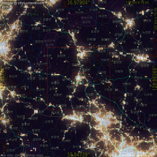
Analysis of Sangju night lights 2016
Square area 10x10 km:
 3.2%
3.2%90-99
5.05%80-89
9.6%70-79
8.08%60-69
5.89%50-59
4.04%40-49
5.22%30-39
7.74%20-29
15.49%10-19
31.48%0-9
4.21%Square area 50x50 km:
0.36%90-99
1.3%80-89
1.11%70-79
1.43%60-69
1.2%50-59
1.75%40-49
1.67%30-39
3.18%20-29
4.78%10-19
8.89%0-9
74.32%Clear (daylight) street map image can be seen on geolist.org.
Map coordinates:
36° 58' 44.5" North, 127° 27' 26.8" East
36° 24' 55" North, 128° 9' 38" East
35° 50' 50.6" North, 128° 51' 49.3" East
Some cities around Sangju sort by population:
• Gumi
37 km =23 mi,  154°
154°
• Gimcheon
32.8 km =20.4 mi,  186°
186°
• Andong
53 km =32.9 mi,  71°
71°
• Mungyeong
20.2 km =12.6 mi,  9°
9°
• Kunwi
42 km =26.1 mi,  118°
118°
• Waegwan
51.6 km =32.1 mi,  155°
155°
• Yeongdong
43.6 km =27.1 mi,  232°
232°
• Jenzan
23 km =14.3 mi, 147°
1837706 (p: 55,640)
Sources (retrieved 2019-11-25):
» NASA, Earths city lights 1995
» NASA city lights 2003
» Earth at Night: Flat Maps 2012, 2016