Gumi night lights from space
Night Light of Gumi (Gyeongsangbuk-do) from space (South Korea) Src. Average luminocity for 10x10km area is 75.9212% and for 50x50km: 31.7395%.
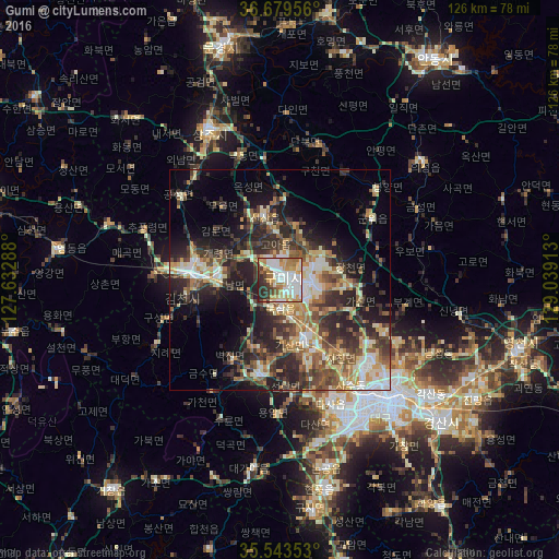

Analysis of Gumi night lights 2016
Square area 10x10 km:
 21.98%
90-99
20.51%80-89
9.89%70-79
12.27%60-69
10.62%50-59
6.04%40-49
4.58%30-39
6.78%20-29
7.33%10-19
0%0-9
0%Square area 50x50 km:
3.38%90-99
6.44%80-89
4.3%70-79
4.11%60-69
4.34%50-59
4.83%40-49
5.17%30-39
7.44%20-29
10.96%10-19
11.11%0-9
37.92%Clear (daylight) street map image can be seen on geolist.org.
Map coordinates:
36° 40' 46.4" North, 127° 37' 58.4" East
36° 6' 49" North, 128° 20' 9.6" East
35° 32' 36.7" North, 129° 2' 20.9" East
Some cities around Gumi sort by population:
• Daegu
35.5 km =22.1 mi,  139°
139°
• Gimcheon
19.4 km =12.1 mi,  272°
272°
• Gyeongsan-si
48.5 km =30.1 mi,  131°
131°
• Hwawŏn
37.7 km =23.4 mi,  156°
156°
• Sangju
37 km =23 mi,  334°
334°
• Kunwi
25.2 km =15.7 mi,  57°
57°
• Waegwan
14.6 km =9.1 mi, 157°
• Jenzan
14.6 km =9.1 mi,  346°
346°
1842225 (p: 291,006)
Sources (retrieved 2019-11-25):
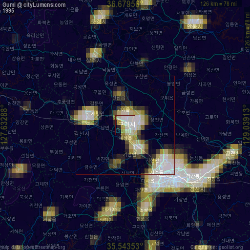
» NASA, Earths city lights 1995
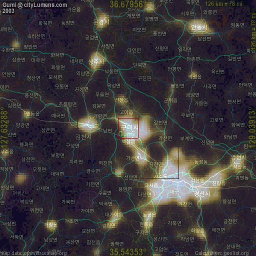
» NASA city lights 2003
» Earth at Night: Flat Maps 2012, 2016