Kunwi night lights from space
Night Light of Kunwi (Gyeongsangbuk-do) from space (South Korea) Src. Average luminocity for 10x10km area is 10.958% and for 50x50km: 15.5176%.
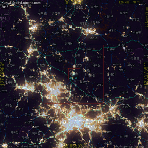
Analysis of Kunwi night lights 2016
Square area 10x10 km:
 0.17%
0.17%90-99
1.75%80-89
1.57%70-79
1.92%60-69
1.4%50-59
0.17%40-49
0.52%30-39
2.27%20-29
4.2%10-19
3.67%0-9
82.34%Square area 50x50 km:
1.63%90-99
3.25%80-89
1.99%70-79
2.07%60-69
2.47%50-59
2.08%40-49
1.96%30-39
3.52%20-29
4.68%10-19
5.66%0-9
70.68%Clear (daylight) street map image can be seen on geolist.org.
Map coordinates:
36° 47' 59.3" North, 127° 52' 10.8" East
36° 14' 5" North, 128° 34' 22" East
35° 39' 55.9" North, 129° 16' 33.3" East
Some cities around Kunwi sort by population:
• Daegu
40.6 km =25.2 mi,  177°
177°
• Gumi
25.2 km =15.7 mi,  237°
237°
• Gimcheon
42.6 km =26.5 mi,  252°
252°
• Andong
39.2 km =24.4 mi,  20°
20°
• Sangju
42 km =26.1 mi,  298°
298°
• Hayang
42.1 km =26.2 mi,  148°
148°
• Waegwan
31.2 km =19.4 mi,  210°
210°
• Jenzan
24.7 km =15.3 mi,  271°
271°
1842016 (p: 34,293)
Sources (retrieved 2019-11-25):
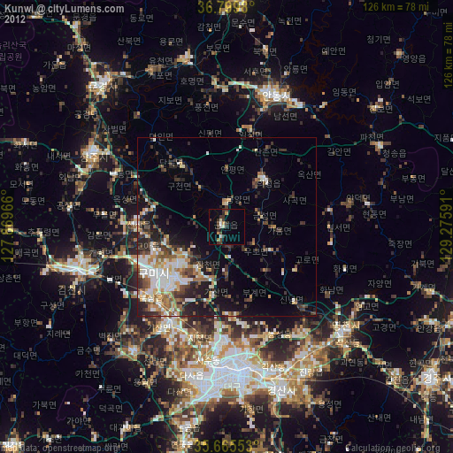
» Earth at Night: Flat Maps 2012, 2016