Hwasun night lights from space
Night Light of Hwasun (Jeollanam-do) from space (South Korea) Src. Average luminocity for 10x10km area is 27.4983% and for 50x50km: 21.7967%.
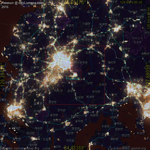
Analysis of Hwasun night lights 2016
Square area 10x10 km:
 2.1%
2.1%90-99
3.85%80-89
2.45%70-79
3.67%60-69
4.9%50-59
5.77%40-49
1.05%30-39
8.39%20-29
7.87%10-19
26.57%0-9
33.39%Square area 50x50 km:
4.51%90-99
4.15%80-89
2.29%70-79
2.34%60-69
3.2%50-59
3.79%40-49
3.35%30-39
3.91%20-29
4.82%10-19
5.89%0-9
61.76%Clear (daylight) street map image can be seen on geolist.org.
Map coordinates:
35° 38' 5.1" North, 126° 17' 3.6" East
35° 3' 40.5" North, 126° 59' 14.9" East
34° 29' 1.3" North, 127° 41' 26.1" East
Some cities around Hwasun sort by population:
• Gwangju
12.3 km =7.6 mi,  327°
327°
• Masan
16 km =9.9 mi,  297°
297°
• Suncheon
47.2 km =29.3 mi,  105°
105°
• Muan
47 km =29.2 mi,  260°
260°
• Yeongam
39.3 km =24.4 mi,  222°
222°
• Naju
24.8 km =15.4 mi, 261°
• Kurye
46.4 km =28.8 mi,  69°
69°
• Beolgyo
39.9 km =24.8 mi,  126°
126°
1843841 (p: 59,914)
Sources (retrieved 2019-11-25):
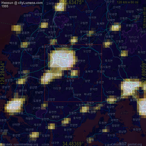
» NASA, Earths city lights 1995
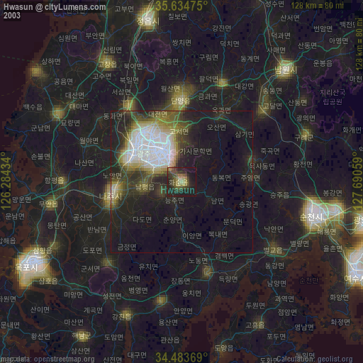
» NASA city lights 2003
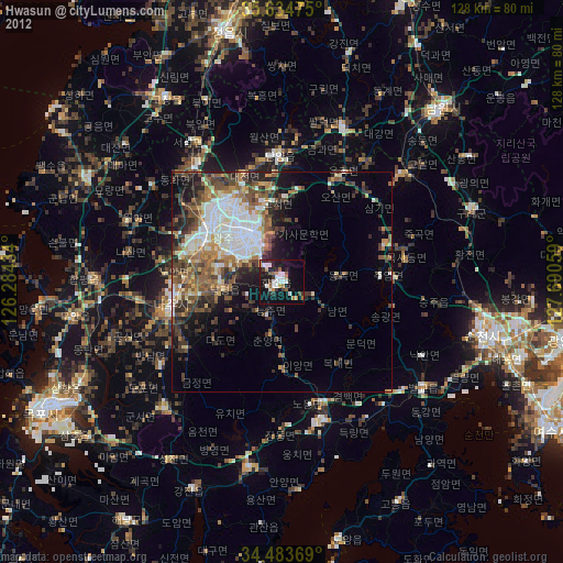
» Earth at Night: Flat Maps 2012, 2016