Gwangju night lights from space
Night Light of Gwangju (Gyeonggi-do) from space (South Korea) Src. Average luminocity for 10x10km area is 71.8523% and for 50x50km: 60.9052%.
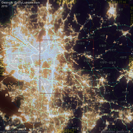
Analysis of Gwangju night lights 2016
Square area 10x10 km:
 6.66%
6.66%90-99
16.56%80-89
11.2%70-79
15.75%60-69
21.59%50-59
16.56%40-49
11.04%30-39
0.65%20-29
0%10-19
0%0-9
0%Square area 50x50 km:
18.29%90-99
13.13%80-89
7.85%70-79
8.34%60-69
8.28%50-59
7.93%40-49
6.98%30-39
5.6%20-29
5.18%10-19
4.68%0-9
13.74%Clear (daylight) street map image can be seen on geolist.org.
Map coordinates:
37° 57' 59.1" North, 126° 33' 14.8" East
37° 24' 36" North, 127° 15' 26" East
36° 50' 57.9" North, 127° 57' 37.3" East
Some cities around Gwangju sort by population:
• Suwon
25.6 km =15.9 mi,  238°
238°
• Seongnam-si
11 km =6.8 mi,  286°
286°
• Icheon-si
21.9 km =13.6 mi,  131°
131°
• Guri-si
23.4 km =14.5 mi,  333°
333°
• Hanam
15.2 km =9.4 mi,  342°
342°
• Wabu
20.2 km =12.6 mi,  350°
350°
• Namyangju
25.5 km =15.8 mi, 351°
• Yangp'yŏng
22.4 km =13.9 mi,  66°
66°
1841810 (p: 81,780)
Sources (retrieved 2019-11-25):
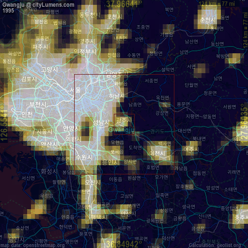
» NASA, Earths city lights 1995
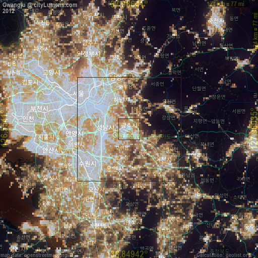
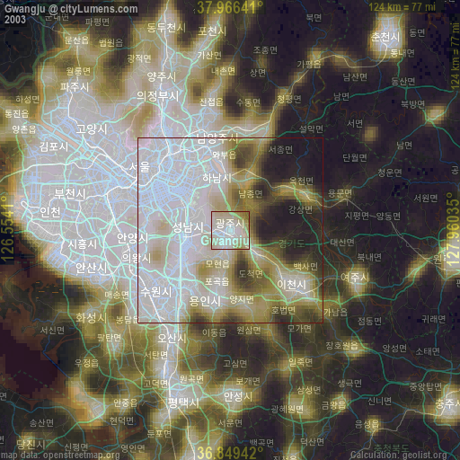
» NASA city lights 2003
» Earth at Night: Flat Maps 2012, 2016