Kaesŏng night lights from space
Night Light of Kaesŏng (Hwanghae-namdo) from space (North Korea) Src. Average luminocity for 10x10km area is 0.5195% and for 50x50km: 9.9718%.
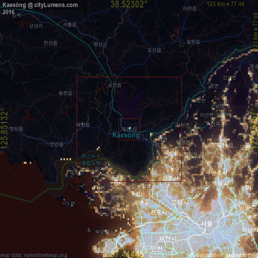
Analysis of Kaesŏng night lights 2016
Square area 10x10 km:
 0%
0%90-99
0%80-89
0%70-79
0.65%60-69
0%50-59
0%40-49
0%30-39
0%20-29
0%10-19
0%0-9
99.35%Square area 50x50 km:
0.5%90-99
1.25%80-89
1.15%70-79
1.62%60-69
2.54%50-59
2.71%40-49
1.7%30-39
1.58%20-29
2.38%10-19
4.69%0-9
79.87%Clear (daylight) street map image can be seen on geolist.org.
Map coordinates:
38° 31' 22.9" North, 125° 51' 4.8" East
37° 58' 15" North, 126° 33' 16" East
37° 24' 52" North, 127° 15' 27.3" East
Some cities around Kaesŏng sort by population:
• Goyang-si, KR
42.8 km =26.6 mi,  144°
144°
• Bucheon-si, KR
56.2 km =34.9 mi,  159°
159°
• Uijeongbu-si, KR
50.2 km =31.2 mi,  120°
120°
• Yangju, KR
47.1 km =29.3 mi,  108°
108°
• Munsan, KR
23.7 km =14.7 mi, 121°
• Ganghwa-gun, KR
25.6 km =15.9 mi,  193°
193°
• Yŏnan-ŭp
35.2 km =21.9 mi,  258°
258°
• Sinmak
57 km =35.4 mi,  330°
330°
1876373 (p: 338,155)
Sources (retrieved 2019-11-25):
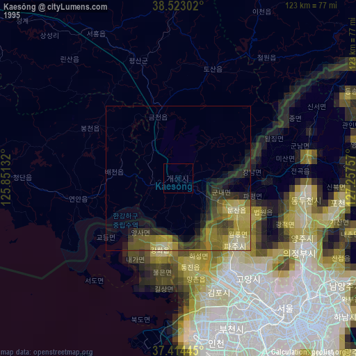
» NASA, Earths city lights 1995
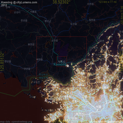
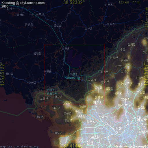
» NASA city lights 2003
» Earth at Night: Flat Maps 2012, 2016