Dieppe Bay Town night lights from space
Night Light of Dieppe Bay Town (Saint John Capesterre) from space (Saint Kitts and Nevis) Src. Average luminocity for 10x10km area is 3.6488% and for 50x50km: 2.5259%.
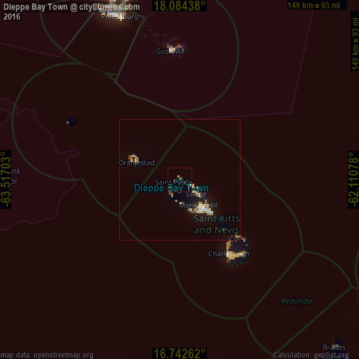
Analysis of Dieppe Bay Town night lights 2016
Square area 10x10 km:
 0%
0%90-99
0%80-89
0.41%70-79
0.83%60-69
0.83%50-59
0.41%40-49
0%30-39
1.65%20-29
1.24%10-19
1.86%0-9
92.77%Square area 50x50 km:
0.13%90-99
0.19%80-89
0.51%70-79
0.37%60-69
0.62%50-59
0.28%40-49
0.1%30-39
0.33%20-29
0.32%10-19
2.12%0-9
95.03%Clear (daylight) street map image can be seen on geolist.org.
Map coordinates:
18° 5' 3.8" North, 63° 31' 1.3" West
17° 24' 53" North, 62° 48' 50" West
16° 44' 33.4" North, 62° 6' 38.8" West
Some cities around Dieppe Bay Town sort by population:
• Basseterre
16.3 km =10.1 mi,  144°
144°
• Saint Paul’s
2.5 km =1.6 mi,  247°
247°
• Middle Island
9.9 km =6.2 mi,  177°
177°
• Nicola Town
7.5 km =4.7 mi,  121°
121°
• Trinity
13.3 km =8.3 mi,  162°
162°
• Cayon
11.2 km =7 mi,  130°
130°
• Sandy Point Town
7.2 km =4.5 mi,  210°
210°
• Monkey Hill
13.6 km =8.5 mi, 138°
3575441 (p: 592)
Sources (retrieved 2019-11-25):
» Earth at Night: Flat Maps 2012, 2016