Wakimachi night lights from space
Night Light of Wakimachi (Tokushima) from space (Japan) Src. Average luminocity for 10x10km area is 5.7552% and for 50x50km: 2.7845%.
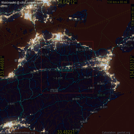
Analysis of Wakimachi night lights 2016
Square area 10x10 km:
 0%
0%90-99
0%80-89
0.7%70-79
0%60-69
0.7%50-59
1.92%40-49
2.8%30-39
1.75%20-29
3.85%10-19
0.52%0-9
87.76%Square area 50x50 km:
0.01%90-99
0.08%80-89
0.14%70-79
0.12%60-69
0.28%50-59
0.66%40-49
0.81%30-39
1.21%20-29
1.58%10-19
2.14%0-9
92.97%Clear (daylight) street map image can be seen on geolist.org.
Map coordinates:
34° 38' 49.6" North, 133° 26' 48.8" East
34° 4' 0" North, 134° 9' 0" East
33° 28' 56" North, 134° 51' 11.3" East
Some cities around Wakimachi sort by population:
• Takamatsu
31 km =19.3 mi,  342°
342°
• Tokushima
38.4 km =23.9 mi,  90°
90°
• Sakaidechō
40.6 km =25.2 mi,  314°
314°
• Komatsushimachō
40.6 km =25.2 mi,  100°
100°
• Ishii
26.9 km =16.7 mi, 89°
• Kamojimachō-jōgejima
18.5 km =11.5 mi, 89°
• Shido
28.6 km =17.8 mi,  4°
4°
• Ikedachō
32 km =19.9 mi,  262°
262°
1848933 (p: 17,659)
Sources (retrieved 2019-11-25):
» Earth at Night: Flat Maps 2012, 2016