Ueno-ebisumachi night lights from space
Night Light of Ueno-ebisumachi (Mie) from space (Japan) Src. Average luminocity for 10x10km area is 29.3828% and for 50x50km: 7.9957%.
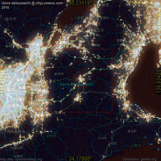


Analysis of Ueno-ebisumachi night lights 2016
Square area 10x10 km:
 0%
0%90-99
2.2%80-89
7.14%70-79
6.78%60-69
4.95%50-59
5.31%40-49
4.95%30-39
3.11%20-29
3.48%10-19
34.25%0-9
27.84%Square area 50x50 km:
0.21%90-99
0.4%80-89
1.44%70-79
0.83%60-69
0.96%50-59
0.94%40-49
1.35%30-39
1.47%20-29
3.33%10-19
8.86%0-9
80.21%Clear (daylight) street map image can be seen on geolist.org.
Map coordinates:
35° 20' 3.1" North, 135° 25' 40.7" East
34° 45' 30.8" North, 136° 7' 51.9" East
34° 10' 44" North, 136° 50' 3.2" East
Some cities around Ueno-ebisumachi sort by population:
• Nara-shi
30.9 km =19.2 mi,  254°
254°
• Kusatsu
32.4 km =20.1 mi,  332°
332°
• Nabari
16.4 km =10.2 mi,  195°
195°
• Hisai-motomachi
32.3 km =20.1 mi,  108°
108°
• Kameyama
30.8 km =19.1 mi,  70°
70°
• Minakuchichō-matoba
23.4 km =14.5 mi,  7°
7°
• Hino
29 km =18 mi,  22°
22°
• Haibara-akanedai
30 km =18.6 mi,  213°
213°
1849414 (p: 61,598)
Sources (retrieved 2019-11-25):
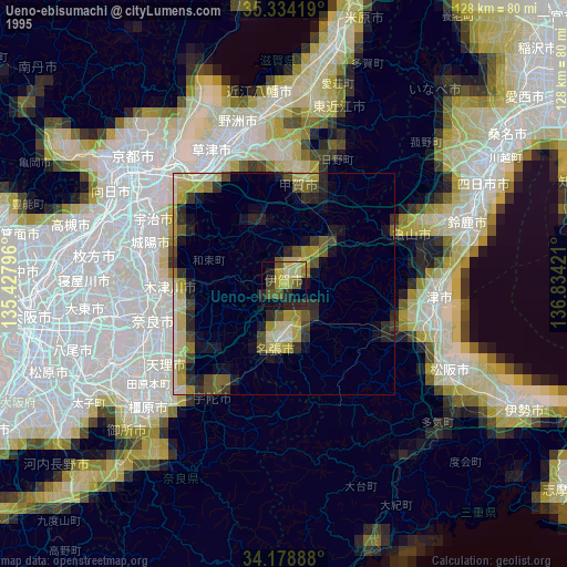
» NASA, Earths city lights 1995
» NASA city lights 2003
» Earth at Night: Flat Maps 2012, 2016