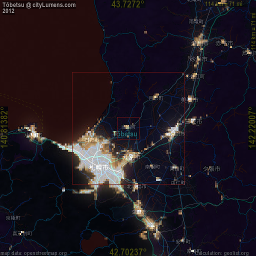
Tōbetsu night lights from space
Night Light of Tōbetsu (Hokkaido) from space (Japan) Src. Average luminocity for 10x10km area is 4.4303% and for 50x50km: 20.3984%.
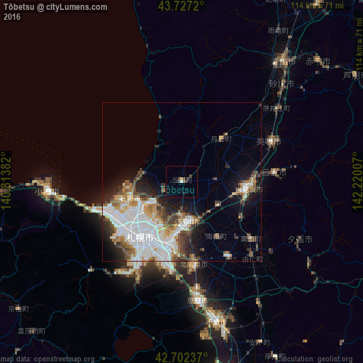
Analysis of Tōbetsu night lights 2016
Square area 10x10 km:
 0.45%
0.45%90-99
0.15%80-89
0%70-79
0%60-69
0.61%50-59
0.61%40-49
2.42%30-39
0.61%20-29
0.91%10-19
1.06%0-9
93.18%Square area 50x50 km:
6.91%90-99
4.1%80-89
1.16%70-79
2.01%60-69
1.98%50-59
2.46%40-49
2.55%30-39
2.45%20-29
3.39%10-19
6.3%0-9
66.67%Clear (daylight) street map image can be seen on geolist.org.
Map coordinates:
43° 43' 37.9" North, 140° 48' 49.8" East
43° 13' 1" North, 141° 31' 1" East
42° 42' 8.5" North, 142° 13' 12.3" East
Some cities around Tōbetsu sort by population:
• Sapporo
21.5 km =13.4 mi,  219°
219°
• Otaru
41.8 km =26 mi,  265°
265°
• Ebetsu
12.4 km =7.7 mi,  167°
167°
• Iwamizawa
19.8 km =12.3 mi,  95°
95°
• Kitahiroshima
27.1 km =16.8 mi, 171°
• Ishikari
13.5 km =8.4 mi,  280°
280°
• Bibai
30.1 km =18.7 mi,  66°
66°
• Sunagawa
43.4 km =27 mi,  46°
46°
2127802 (p: 21,818)
Sources (retrieved 2019-11-25):
» Earth at Night: Flat Maps 2012, 2016