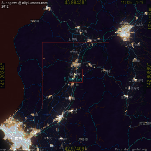
Sunagawa night lights from space
Night Light of Sunagawa (Hokkaido) from space (Japan) Src. Average luminocity for 10x10km area is 7.3048% and for 50x50km: 2.0513%.
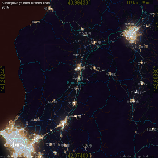
Analysis of Sunagawa night lights 2016
Square area 10x10 km:
 0%
0%90-99
0%80-89
0.63%70-79
0%60-69
0%50-59
2.54%40-49
1.75%30-39
3.33%20-29
3.02%10-19
2.7%0-9
86.03%Square area 50x50 km:
0.04%90-99
0.09%80-89
0.05%70-79
0.11%60-69
0.3%50-59
0.67%40-49
0.54%30-39
0.76%20-29
0.78%10-19
0.83%0-9
95.83%Clear (daylight) street map image can be seen on geolist.org.
Map coordinates:
43° 59' 39.8" North, 141° 12' 8.8" East
43° 29' 11" North, 141° 54' 20" East
42° 58' 26.7" North, 142° 36' 31.3" East
Some cities around Sunagawa sort by population:
• Iwamizawa
33.9 km =21.1 mi,  200°
200°
• Takikawa
7.4 km =4.6 mi,  0°
0°
• Bibai
18.4 km =11.4 mi,  191°
191°
• Fukagawa
26.9 km =16.7 mi,  23°
23°
• Shimo-furano
41.5 km =25.8 mi,  111°
111°
• Ashibetsu
22.7 km =14.1 mi,  83°
83°
• Akabira
13.9 km =8.6 mi,  58°
58°
• Utashinai
12.1 km =7.5 mi,  73°
73°
2127955 (p: 20,102)
Sources (retrieved 2019-11-25):
» Earth at Night: Flat Maps 2012, 2016