Tanabe night lights from space
Night Light of Tanabe (Kyoto) from space (Japan) Src. Average luminocity for 10x10km area is 65.0495% and for 50x50km: 51.7558%.
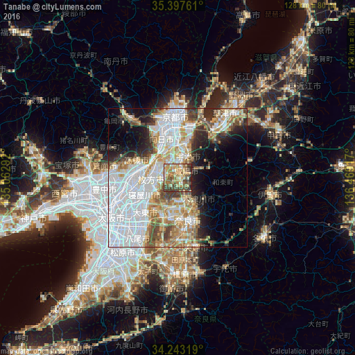
Analysis of Tanabe night lights 2016
Square area 10x10 km:
 4.4%
4.4%90-99
11.17%80-89
11.17%70-79
16.67%60-69
17.77%50-59
9.52%40-49
17.95%30-39
7.33%20-29
4.03%10-19
0%0-9
0%Square area 50x50 km:
19.75%90-99
10.02%80-89
6.47%70-79
5.41%60-69
5.88%50-59
4.76%40-49
4.81%30-39
3.72%20-29
5.81%10-19
7.47%0-9
25.91%Clear (daylight) street map image can be seen on geolist.org.
Map coordinates:
35° 23' 51.4" North, 135° 3' 46.5" East
34° 49' 20.7" North, 135° 45' 57.7" East
34° 14' 35.5" North, 136° 28' 9" East
Some cities around Tanabe sort by population:
• Hirakata
10.7 km =6.6 mi,  264°
264°
• Nara-shi
15.7 km =9.8 mi,  166°
166°
• Takatsuki
13.9 km =8.6 mi,  281°
281°
• Neyagawa
14.1 km =8.8 mi,  243°
243°
• Uji
8.3 km =5.2 mi,  24°
24°
• Ikoma
16.6 km =10.3 mi,  201°
201°
• Yawata
7.8 km =4.8 mi,  312°
312°
• Mukō
16.9 km =10.5 mi,  340°
340°
1850707 (p: 65,903)
Sources (retrieved 2019-11-25):
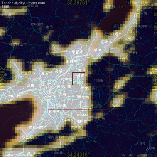
» NASA, Earths city lights 1995
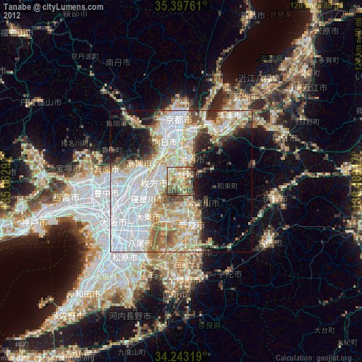
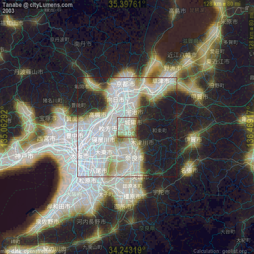
» NASA city lights 2003
» Earth at Night: Flat Maps 2012, 2016