Tagawa night lights from space
Night Light of Tagawa (Fukuoka) from space (Japan) Src. Average luminocity for 10x10km area is 32.1136% and for 50x50km: 18.8193%.
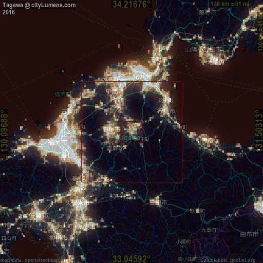


Analysis of Tagawa night lights 2016
Square area 10x10 km:
 0%
0%90-99
0.92%80-89
4.4%70-79
5.13%60-69
7.69%50-59
8.97%40-49
5.13%30-39
8.97%20-29
10.81%10-19
37.36%0-9
10.62%Square area 50x50 km:
0.82%90-99
1.88%80-89
2.32%70-79
2.34%60-69
3.71%50-59
4.68%40-49
2.52%30-39
4.21%20-29
7.64%10-19
15.49%0-9
54.39%Clear (daylight) street map image can be seen on geolist.org.
Map coordinates:
34° 13' 0.3" North, 130° 5' 48.8" East
33° 37' 60" North, 130° 48' 0" East
33° 2' 45.3" North, 131° 30' 11.3" East
Some cities around Tagawa sort by population:
• Iizuka
10.5 km =6.5 mi,  271°
271°
• Yukuhashi
20 km =12.4 mi,  57°
57°
• Nōgata
13.9 km =8.6 mi,  329°
329°
• Nakama
22.1 km =13.7 mi,  337°
337°
• Sasaguri
23.1 km =14.4 mi, 265°
• Miyata
15.9 km =9.9 mi,  301°
301°
• Kawasaki
4 km =2.5 mi,  159°
159°
• Tsuiki
22.4 km =13.9 mi,  78°
78°
1851273 (p: 51,608)
Sources (retrieved 2019-11-25):
» NASA, Earths city lights 1995
» NASA city lights 2003
» Earth at Night: Flat Maps 2012, 2016