Kawasaki night lights from space
Night Light of Kawasaki (Fukuoka) from space (Japan) Src. Average luminocity for 10x10km area is 17.8022% and for 50x50km: 15.0294%.
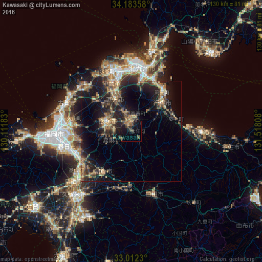
Analysis of Kawasaki night lights 2016
Square area 10x10 km:
 0%
0%90-99
0%80-89
0.73%70-79
2.56%60-69
4.76%50-59
5.31%40-49
4.21%30-39
4.95%20-29
3.3%10-19
22.34%0-9
51.83%Square area 50x50 km:
0.28%90-99
0.96%80-89
1.81%70-79
1.81%60-69
3.17%50-59
3.98%40-49
2.31%30-39
3.49%20-29
6.48%10-19
13.89%0-9
61.82%Clear (daylight) street map image can be seen on geolist.org.
Map coordinates:
34° 11' 0.9" North, 130° 6' 42.6" East
33° 35' 59.7" North, 130° 48' 53.8" East
33° 0' 44.3" North, 131° 31' 5.1" East
Some cities around Kawasaki sort by population:
• Iizuka
12.5 km =7.8 mi,  288°
288°
• Yukuhashi
21.1 km =13.1 mi,  47°
47°
• Nōgata
17.8 km =11.1 mi,  331°
331°
• Tagawa
4 km =2.5 mi,  339°
339°
• Sasaguri
24.5 km =15.2 mi,  274°
274°
• Miyata
19.2 km =11.9 mi,  308°
308°
• Shiida
23.3 km =14.5 mi,  75°
75°
• Tsuiki
22.2 km =13.8 mi,  68°
68°
1859647 (p: 19,141)
Sources (retrieved 2019-11-25):
» Earth at Night: Flat Maps 2012, 2016