Shizukuishi night lights from space
Night Light of Shizukuishi (Iwate) from space (Japan) Src. Average luminocity for 10x10km area is 2.7646% and for 50x50km: 4.4674%.
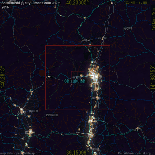
Analysis of Shizukuishi night lights 2016
Square area 10x10 km:
 0%
0%90-99
0%80-89
0%70-79
0.81%60-69
0.49%50-59
0.32%40-49
1.62%30-39
0.65%20-29
0.65%10-19
0%0-9
95.45%Square area 50x50 km:
0.41%90-99
0.59%80-89
0.3%70-79
0.53%60-69
0.78%50-59
0.67%40-49
0.96%30-39
1.03%20-29
1.41%10-19
3.07%0-9
90.25%Clear (daylight) street map image can be seen on geolist.org.
Map coordinates:
40° 13' 59" North, 140° 16' 52.7" East
39° 41' 38.9" North, 140° 59' 3.9" East
39° 9' 3.6" North, 141° 41' 15.2" East
Some cities around Shizukuishi sort by population:
• Morioka
14.2 km =8.8 mi,  87°
87°
• Kitakami
47.1 km =29.3 mi,  166°
166°
• Hanamaki
36.4 km =22.6 mi,  161°
161°
• Yokote
56.1 km =34.9 mi,  221°
221°
• Ōmagari
50.8 km =31.6 mi,  237°
237°
• Hanawa
57 km =35.4 mi,  342°
342°
• Tōno
63.1 km =39.2 mi,  131°
131°
• Kakunodatemachi
37.6 km =23.4 mi,  251°
251°
2110994 (p: 19,866)
Sources (retrieved 2019-11-25):
» Earth at Night: Flat Maps 2012, 2016