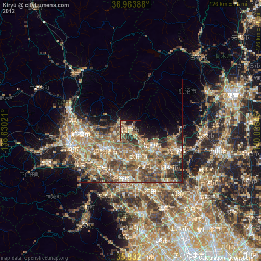
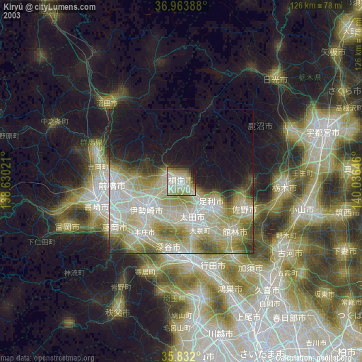
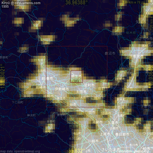
Kiryū night lights from space
Night Light of Kiryū (Gunma) from space (Japan) Src. Average luminocity for 10x10km area is 51.5962% and for 50x50km: 31.2186%.
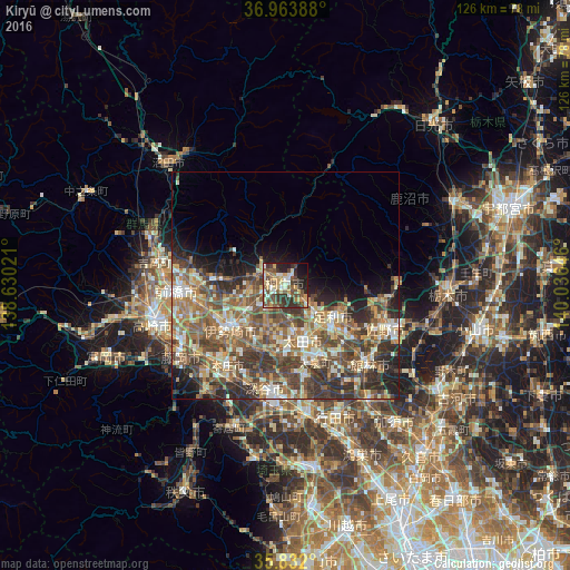
Analysis of Kiryū night lights 2016
Square area 10x10 km:
 4.72%
4.72%90-99
8.57%80-89
9.27%70-79
9.27%60-69
2.62%50-59
12.94%40-49
15.03%30-39
12.76%20-29
9.62%10-19
12.06%0-9
3.15%Square area 50x50 km:
2.27%90-99
5.62%80-89
4.13%70-79
4.71%60-69
6.01%50-59
7.3%40-49
7.93%30-39
6.88%20-29
6.59%10-19
6.14%0-9
42.41%Clear (daylight) street map image can be seen on geolist.org.
Map coordinates:
36° 57' 50" North, 138° 37' 48.8" East
36° 24' 0" North, 139° 19' 60" East
35° 49' 55.2" North, 140° 2' 11.3" East
Some cities around Kiryū sort by population:
• Ashikaga
12.8 km =8 mi,  125°
125°
• Ōta
11.5 km =7.1 mi,  164°
164°
• Isesaki
15.1 km =9.4 mi,  232°
232°
• Honjō
22.1 km =13.7 mi,  215°
215°
• Tamamura
22.4 km =13.9 mi,  240°
240°
• Sakai-nakajima
16.6 km =10.3 mi,  206°
206°
• Menuma
20.2 km =12.6 mi,  167°
167°
• Ōmamachō-ōmama
6.3 km =3.9 mi,  304°
304°
1859405 (p: 110,219)
Sources (retrieved 2019-11-25):
» NASA, Earths city lights 1995
» NASA city lights 2003
» Earth at Night: Flat Maps 2012, 2016