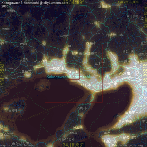
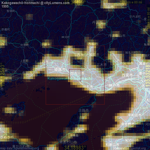
Kakogawachō-honmachi night lights from space
Night Light of Kakogawachō-honmachi (Hyōgo) from space (Japan) Src. Average luminocity for 10x10km area is 70.7179% and for 50x50km: 25.8321%.

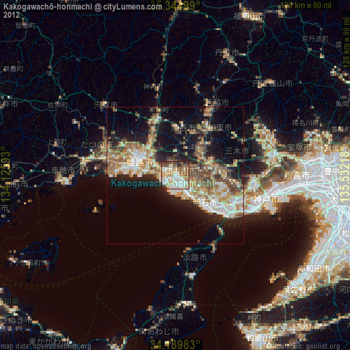
Analysis of Kakogawachō-honmachi night lights 2016
Square area 10x10 km:
 15.02%
90-99
17.95%80-89
12.64%70-79
14.47%60-69
8.79%50-59
6.04%40-49
5.49%30-39
7.69%20-29
10.99%10-19
0.92%0-9
0%Square area 50x50 km:
3.35%90-99
4.16%80-89
3.48%70-79
4%60-69
4.2%50-59
4.01%40-49
3.32%30-39
4.58%20-29
7.68%10-19
11.97%0-9
49.25%Clear (daylight) street map image can be seen on geolist.org.
Map coordinates:
35° 20' 42" North, 134° 7' 33.3" East
34° 46' 9.9" North, 134° 49' 44.6" East
34° 11' 23.4" North, 135° 31' 55.8" East
Some cities around Kakogawachō-honmachi sort by population:
• Himeji
12.9 km =8 mi,  294°
294°
• Akashi
20.6 km =12.8 mi,  127°
127°
• Miki
14.5 km =9 mi,  76°
76°
• Ono
13.1 km =8.1 mi,  46°
46°
• Nishiwaki
27.3 km =17 mi,  28°
28°
• Shirahamachō-usazakiminami
10.4 km =6.5 mi,  278°
278°
• Yashiro
20.6 km =12.8 mi,  37°
37°
• Yonedacho Sendo
0.8 km =0.5 mi,  334°
334°
1860704 (p: 271,634)
Sources (retrieved 2019-11-25):
» NASA, Earths city lights 1995
» NASA city lights 2003
» Earth at Night: Flat Maps 2012, 2016