Iwanai night lights from space
Night Light of Iwanai (Hokkaido) from space (Japan) Src. Average luminocity for 10x10km area is 7.4952% and for 50x50km: 1.5167%.
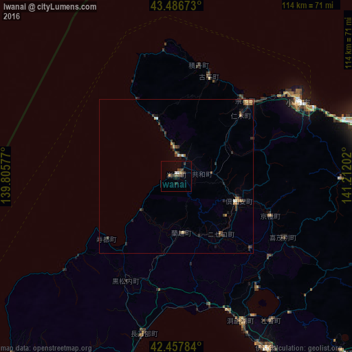
Analysis of Iwanai night lights 2016
Square area 10x10 km:
 0.79%
0.79%90-99
0.48%80-89
0.32%70-79
0.95%60-69
0%50-59
1.9%40-49
1.9%30-39
3.17%20-29
1.9%10-19
0%0-9
88.57%Square area 50x50 km:
0.06%90-99
0.13%80-89
0.11%70-79
0.12%60-69
0.37%50-59
0.19%40-49
0.42%30-39
0.47%20-29
0.52%10-19
0.39%0-9
97.23%Clear (daylight) street map image can be seen on geolist.org.
Map coordinates:
43° 29' 12.2" North, 139° 48' 20.8" East
42° 58' 28" North, 140° 30' 32" East
42° 27' 28.2" North, 141° 12' 43.3" East
Some cities around Iwanai sort by population:
• Sapporo
69.1 km =42.9 mi,  81°
81°
• Otaru
46.7 km =29 mi,  59°
59°
• Ebetsu
85.9 km =53.4 mi, 80°
• Muroran
82.9 km =51.5 mi,  151°
151°
• Ishikari
74.7 km =46.4 mi,  66°
66°
• Date
63.5 km =39.5 mi, 152°
• Yoichi
33.2 km =20.6 mi,  39°
39°
• Shiraoi
83.3 km =51.8 mi,  124°
124°
2129868 (p: 15,584)
Sources (retrieved 2019-11-25):
» Earth at Night: Flat Maps 2012, 2016