Hagi night lights from space
Night Light of Hagi (Yamaguchi) from space (Japan) Src. Average luminocity for 10x10km area is 7.7273% and for 50x50km: 0.9566%.
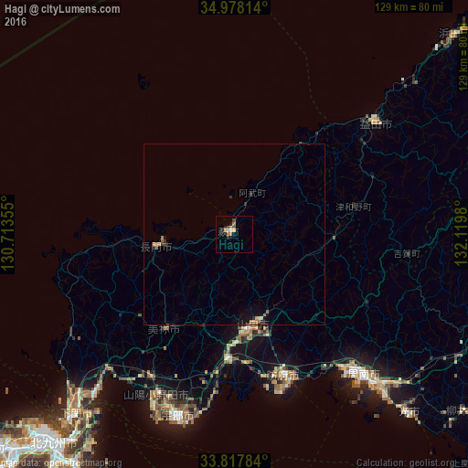
Analysis of Hagi night lights 2016
Square area 10x10 km:
 0.35%
0.35%90-99
1.05%80-89
1.4%70-79
1.4%60-69
1.4%50-59
1.22%40-49
0.87%30-39
1.4%20-29
1.22%10-19
0.87%0-9
88.81%Square area 50x50 km:
0.01%90-99
0.04%80-89
0.14%70-79
0.14%60-69
0.24%50-59
0.2%40-49
0.06%30-39
0.14%20-29
0.24%10-19
0.58%0-9
98.19%Clear (daylight) street map image can be seen on geolist.org.
Map coordinates:
34° 58' 41.3" North, 130° 42' 48.8" East
34° 24' 0" North, 131° 25' 0" East
33° 49' 4.2" North, 132° 7' 11.3" East
Some cities around Hagi sort by population:
• Ube
53 km =32.9 mi,  196°
196°
• Yamaguchi
24.5 km =15.2 mi,  169°
169°
• Hōfu
41.3 km =25.7 mi,  160°
160°
• Tokuyama
53.5 km =33.2 mi,  136°
136°
• Masuda
49.5 km =30.8 mi,  53°
53°
• Onoda
49.2 km =30.6 mi,  205°
205°
• Ogōri-shimogō
33.4 km =20.8 mi,  182°
182°
• Nagato
20 km =12.4 mi,  264°
264°
1863418 (p: 43,826)
Sources (retrieved 2019-11-25):
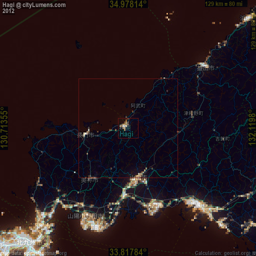
» Earth at Night: Flat Maps 2012, 2016