Hōfu night lights from space
Night Light of Hōfu (Yamaguchi) from space (Japan) Src. Average luminocity for 10x10km area is 33.8969% and for 50x50km: 6.8149%.
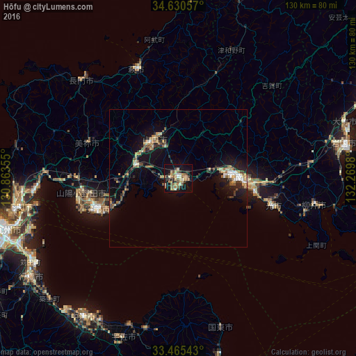

Analysis of Hōfu night lights 2016
Square area 10x10 km:
 1.05%
1.05%90-99
3.67%80-89
8.22%70-79
3.67%60-69
7.87%50-59
8.92%40-49
2.27%30-39
4.02%20-29
4.37%10-19
37.94%0-9
18.01%Square area 50x50 km:
0.43%90-99
0.59%80-89
1.37%70-79
0.68%60-69
0.95%50-59
1.17%40-49
0.73%30-39
0.93%20-29
1.62%10-19
6.77%0-9
84.74%Clear (daylight) street map image can be seen on geolist.org.
Map coordinates:
34° 37' 50.1" North, 130° 51' 48.8" East
34° 3' 0" North, 131° 34' 0" East
33° 27' 55.5" North, 132° 16' 11.3" East
Some cities around Hōfu sort by population:
• Ube
31.4 km =19.5 mi,  247°
247°
• Yamaguchi
17.5 km =10.9 mi,  328°
328°
• Tokuyama
23 km =14.3 mi,  90°
90°
• Kudamatsu
28.2 km =17.5 mi,  101°
101°
• Hikari
36.9 km =22.9 mi,  106°
106°
• Onoda
35.7 km =22.2 mi,  261°
261°
• Hagi
41.3 km =25.7 mi,  340°
340°
• Ogōri-shimogō
16.3 km =10.1 mi,  289°
289°
1862302 (p: 116,925)
Sources (retrieved 2019-11-25):
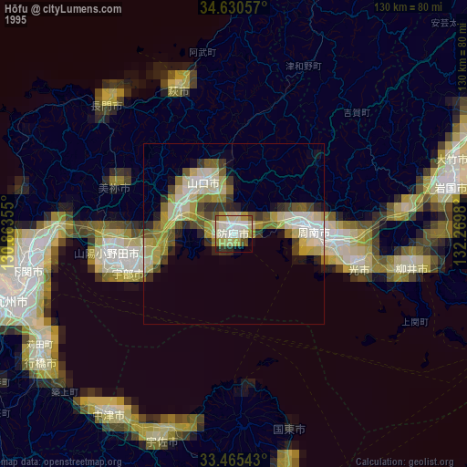
» NASA, Earths city lights 1995
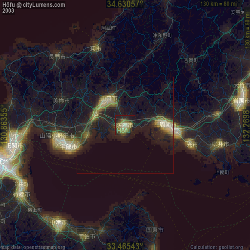
» NASA city lights 2003
» Earth at Night: Flat Maps 2012, 2016