Fujisawa night lights from space
Night Light of Fujisawa (Kanagawa) from space (Japan) Src. Average luminocity for 10x10km area is 88.3352% and for 50x50km: 49.9396%.
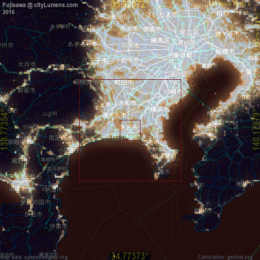
Analysis of Fujisawa night lights 2016
Square area 10x10 km:
 28.75%
90-99
35.9%80-89
13.74%70-79
9.71%60-69
5.31%50-59
1.47%40-49
0.73%30-39
3.85%20-29
0.55%10-19
0%0-9
0%Square area 50x50 km:
18.54%90-99
14.83%80-89
5.71%70-79
4.11%60-69
3.75%50-59
2.37%40-49
2.85%30-39
3.5%20-29
5.6%10-19
7.91%0-9
30.83%Clear (daylight) street map image can be seen on geolist.org.
Map coordinates:
35° 55' 14.6" North, 138° 46' 24.7" East
35° 20' 57.3" North, 139° 28' 36" East
34° 46' 25.4" North, 140° 10' 47.2" East
Some cities around Fujisawa sort by population:
• Hiratsuka
12.9 km =8 mi,  259°
259°
• Chigasaki
6.7 km =4.2 mi, 257°
• Atsugi
14.2 km =8.8 mi,  316°
316°
• Kamakura
8 km =5 mi,  123°
123°
• Isehara
16.1 km =10 mi,  290°
290°
• Zushi
11 km =6.8 mi, 123°
• Ōiso
15 km =9.3 mi, 255°
• Hayama
12.2 km =7.6 mi,  131°
131°
1864092 (p: 394,624)
Sources (retrieved 2019-11-25):
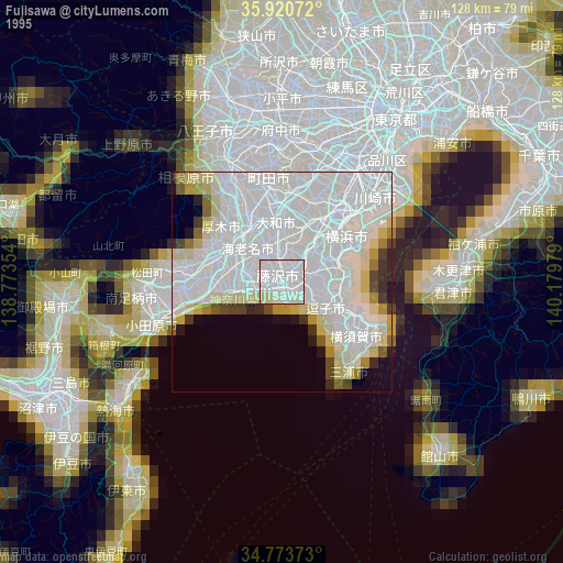
» NASA, Earths city lights 1995
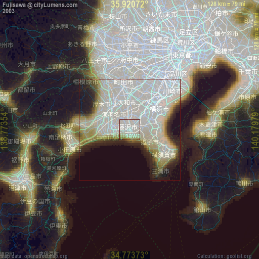
» NASA city lights 2003
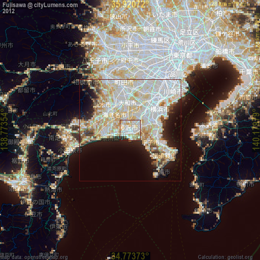
» Earth at Night: Flat Maps 2012, 2016