Akashi night lights from space
Night Light of Akashi (Hyōgo) from space (Japan) Src. Average luminocity for 10x10km area is 68.5612% and for 50x50km: 26.9081%.
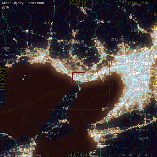
Analysis of Akashi night lights 2016
Square area 10x10 km:
 21.68%
90-99
22.73%80-89
4.9%70-79
5.24%60-69
10.84%50-59
3.67%40-49
1.22%30-39
6.47%20-29
16.61%10-19
6.47%0-9
0.17%Square area 50x50 km:
4.34%90-99
5.27%80-89
3.49%70-79
3.2%60-69
3.75%50-59
3.93%40-49
3.75%30-39
5.44%20-29
8.43%10-19
9.76%0-9
48.65%Clear (daylight) street map image can be seen on geolist.org.
Map coordinates:
35° 13' 53.8" North, 134° 18' 13.5" East
34° 39' 18.9" North, 135° 0' 24.7" East
34° 4' 29.4" North, 135° 42' 36" East
Some cities around Akashi sort by population:
• Kobe
16.6 km =10.3 mi,  76°
76°
• Kakogawachō-honmachi
20.6 km =12.8 mi,  307°
307°
• Ashiya
28.2 km =17.5 mi,  73°
73°
• Miki
16.2 km =10.1 mi,  352°
352°
• Ono
22.7 km =14.1 mi,  342°
342°
• Shirahamachō-usazakiminami
30.1 km =18.7 mi,  298°
298°
• Yashiro
29.3 km =18.2 mi, 352°
• Yonedacho Sendo
21.3 km =13.2 mi, 308°
1847966 (p: 297,279)
Sources (retrieved 2019-11-25):
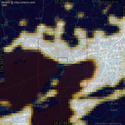
» NASA, Earths city lights 1995
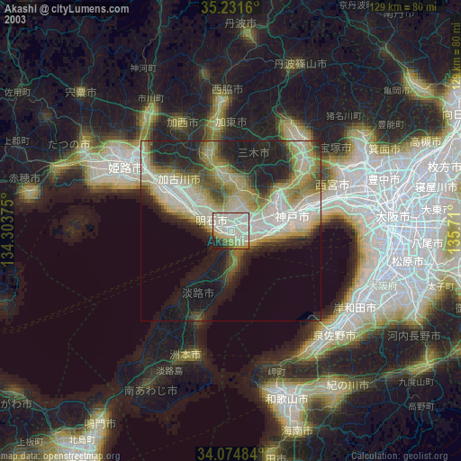
» NASA city lights 2003
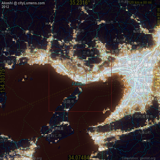
» Earth at Night: Flat Maps 2012, 2016