Ageoshimo night lights from space
Night Light of Ageoshimo (Saitama) from space (Japan) Src. Average luminocity for 10x10km area is 89.7399% and for 50x50km: 70.7509%.
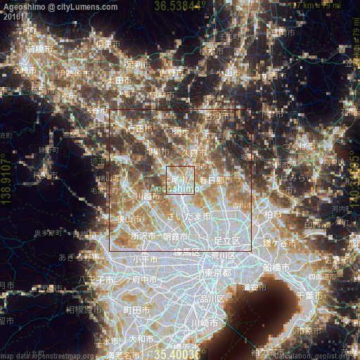
Analysis of Ageoshimo night lights 2016
Square area 10x10 km:
 30.77%
90-99
29.67%80-89
13.92%70-79
19.23%60-69
6.41%50-59
0%40-49
0%30-39
0%20-29
0%10-19
0%0-9
0%Square area 50x50 km:
19.63%90-99
15.69%80-89
8.5%70-79
9.66%60-69
13.17%50-59
9.31%40-49
8.12%30-39
7.71%20-29
5.84%10-19
2.36%0-9
0%Clear (daylight) street map image can be seen on geolist.org.
Map coordinates:
36° 32' 18.4" North, 138° 54' 38.5" East
35° 58' 17.2" North, 139° 36' 49.8" East
35° 24' 1.3" North, 140° 19' 1" East
Some cities around Ageoshimo sort by population:
• Saitama
8 km =5 mi,  151°
151°
• Yono
10 km =6.2 mi,  169°
169°
• Iwatsuki
7.5 km =4.7 mi,  95°
95°
• Okegawa
6 km =3.7 mi,  301°
301°
• Kukichūō
12 km =7.5 mi,  27°
27°
• Hasuda
3.2 km =2 mi,  90°
90°
• Shiraoka
6.7 km =4.2 mi,  38°
38°
• Shōbu
10.7 km =6.6 mi,  353°
353°
1865714 (p: 219,401)
Sources (retrieved 2019-11-25):
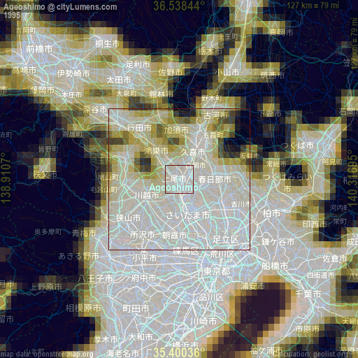
» NASA, Earths city lights 1995
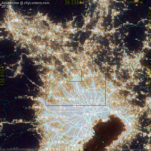
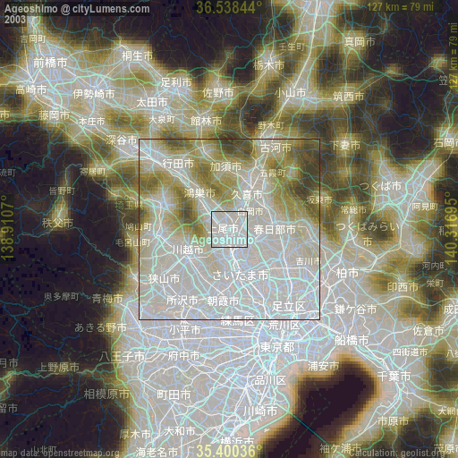
» NASA city lights 2003
» Earth at Night: Flat Maps 2012, 2016