Portmore night lights from space
Night Light of Portmore (Saint Catherine) from space (Jamaica) Src. Average luminocity for 10x10km area is 52.7294% and for 50x50km: 19.6226%.
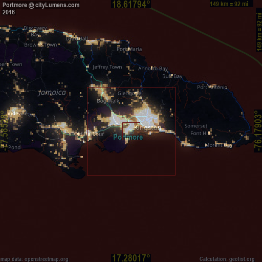
Analysis of Portmore night lights 2016
Square area 10x10 km:
 10.82%
90-99
10.39%80-89
12.34%70-79
2.81%60-69
5.63%50-59
8.01%40-49
4.33%30-39
7.36%20-29
14.5%10-19
19.26%0-9
4.55%Square area 50x50 km:
3.7%90-99
2.99%80-89
4.19%70-79
1.9%60-69
1.77%50-59
1.65%40-49
2.39%30-39
2.8%20-29
5.72%10-19
12.44%0-9
60.45%Clear (daylight) street map image can be seen on geolist.org.
Map coordinates:
18° 37' 4.6" North, 77° 35' 7" West
17° 57' 1.2" North, 76° 52' 55.7" West
17° 16' 48.6" North, 76° 10' 44.5" West
Some cities around Portmore sort by population:
• Kingston
10.7 km =6.6 mi,  60°
60°
• New Kingston
12.2 km =7.6 mi, 58°
• Spanish Town
9.2 km =5.7 mi,  299°
299°
• Half Way Tree
11.2 km =7 mi,  51°
51°
• Bog Walk
21.3 km =13.2 mi,  322°
322°
• Constant Spring
14.6 km =9.1 mi,  39°
39°
• Stony Hill
17.6 km =10.9 mi, 35°
• Old Harbour Bay
23.2 km =14.4 mi,  258°
258°
3488981 (p: 102,861)
Sources (retrieved 2019-11-25):
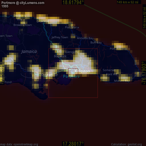
» NASA, Earths city lights 1995
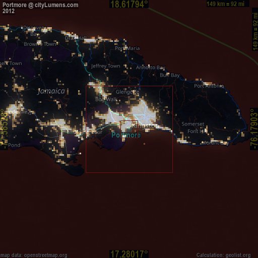
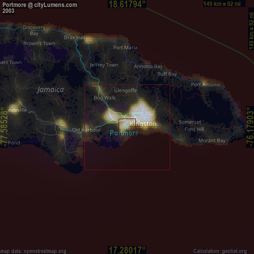
» NASA city lights 2003
» Earth at Night: Flat Maps 2012, 2016