Kingston night lights from space
Night Light of Kingston from space (Jamaica) Src. Average luminocity for 10x10km area is 87.2273% and for 50x50km: 17.8245%.
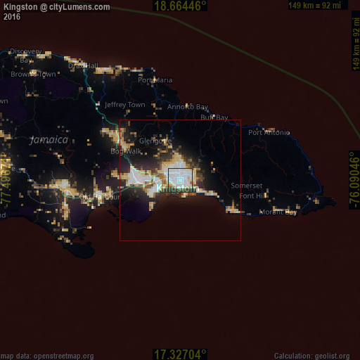
Analysis of Kingston night lights 2016
Square area 10x10 km:
 53.46%
90-99
19.48%80-89
6.28%70-79
3.03%60-69
0.65%50-59
3.68%40-49
2.16%30-39
9.74%20-29
1.52%10-19
0%0-9
0%Square area 50x50 km:
3.63%90-99
2.8%80-89
3.65%70-79
1.64%60-69
1.62%50-59
1.54%40-49
2.21%30-39
2.53%20-29
5.3%10-19
9.28%0-9
65.8%Clear (daylight) street map image can be seen on geolist.org.
Map coordinates:
18° 39' 52.1" North, 77° 29' 48.2" West
17° 59' 49.3" North, 76° 47' 36.9" West
17° 19' 37.3" North, 76° 5' 25.7" West
Some cities around Kingston sort by population:
• New Kingston
1.6 km =1 mi,  43°
43°
• Spanish Town
17.3 km =10.7 mi,  267°
267°
• Portmore
10.7 km =6.6 mi,  240°
240°
• Half Way Tree
1.8 km =1.1 mi,  340°
340°
• Bog Walk
25.3 km =15.7 mi,  297°
297°
• Constant Spring
6 km =3.7 mi,  359°
359°
• Stony Hill
9.2 km =5.7 mi,  5°
5°
• Yallahs
28 km =17.4 mi,  119°
119°
3489854 (p: 937,700)
Sources (retrieved 2019-11-25):
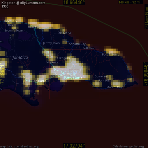
» NASA, Earths city lights 1995
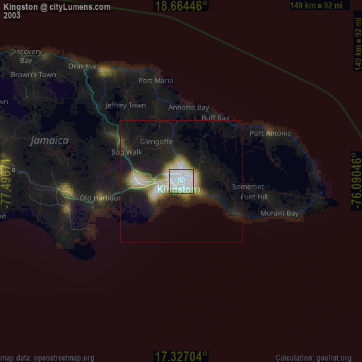
» NASA city lights 2003
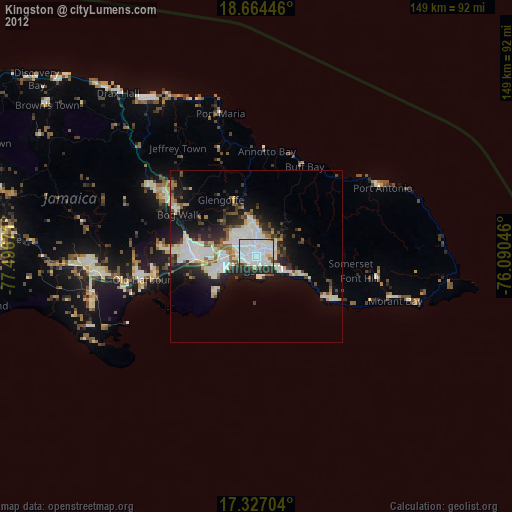
» Earth at Night: Flat Maps 2012, 2016