Vicenza night lights from space
Night Light of Vicenza (Veneto) from space (Italy) Src. Average luminocity for 10x10km area is 76.2712% and for 50x50km: 45.6561%.
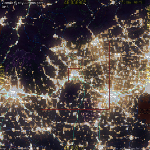
Analysis of Vicenza night lights 2016
Square area 10x10 km:
 20.15%
90-99
21.67%80-89
5.76%70-79
6.67%60-69
16.06%50-59
19.09%40-49
7.58%30-39
3.03%20-29
0%10-19
0%0-9
0%Square area 50x50 km:
6.12%90-99
8.47%80-89
4.74%70-79
5.37%60-69
6.54%50-59
8.9%40-49
9.43%30-39
10.31%20-29
16.08%10-19
15.39%0-9
8.65%Clear (daylight) street map image can be seen on geolist.org.
Map coordinates:
46° 2' 13.1" North, 10° 50' 39.8" East
45° 32' 48.2" North, 11° 32' 51" East
45° 3' 7.7" North, 12° 15' 2.3" East
Some cities around Vicenza sort by population:
• Montecchio Maggiore-Alte Ceccato
11.6 km =7.2 mi,  245°
245°
• Dueville
9.9 km =6.2 mi,  1°
1°
• Caldogno-Rettorgole-Cresole
7.6 km =4.7 mi,  332°
332°
• Altavilla Vicentina
7.2 km =4.5 mi,  238°
238°
• Creazzo
5.7 km =3.5 mi, 252°
• Torri di Quartesolo
6.8 km =4.2 mi,  117°
117°
• Camisano Vicentino
12.8 km =8 mi,  102°
102°
• Monticello Conte Otto
6 km =3.7 mi,  18°
18°
3164419 (p: 107,129)
Sources (retrieved 2019-11-25):
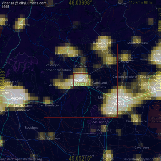
» NASA, Earths city lights 1995
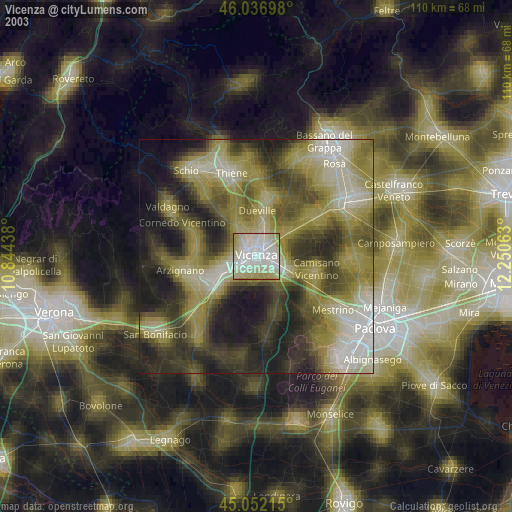
» NASA city lights 2003
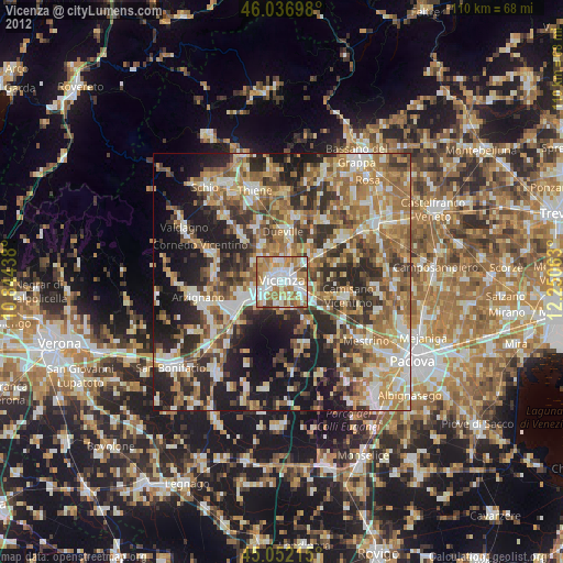
» Earth at Night: Flat Maps 2012, 2016