Venaria Reale night lights from space
Night Light of Venaria Reale (Piedmont) from space (Italy) Src. Average luminocity for 10x10km area is 77.2742% and for 50x50km: 38.8924%.
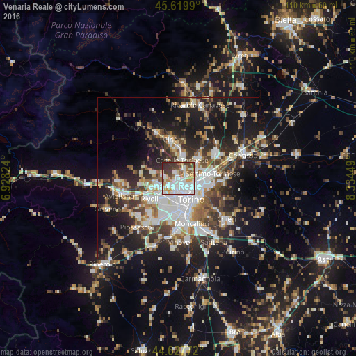
Analysis of Venaria Reale night lights 2016
Square area 10x10 km:
 31.82%
90-99
18.33%80-89
7.27%70-79
9.39%60-69
5.91%50-59
4.7%40-49
8.03%30-39
10.61%20-29
3.94%10-19
0%0-9
0%Square area 50x50 km:
8.53%90-99
8.6%80-89
3.22%70-79
3.66%60-69
3.94%50-59
5.18%40-49
5.86%30-39
6.25%20-29
11.08%10-19
22.66%0-9
21.03%Clear (daylight) street map image can be seen on geolist.org.
Map coordinates:
45° 37' 11.6" North, 6° 55' 41.7" East
45° 7' 33.5" North, 7° 37' 52.9" East
44° 37' 39.8" North, 8° 20' 4.2" East
Some cities around Venaria Reale sort by population:
• Turin
7.5 km =4.7 mi,  144°
144°
• Collegno
7.3 km =4.5 mi,  223°
223°
• Grugliasco
7.9 km =4.9 mi,  211°
211°
• Pianezza
6.8 km =4.2 mi,  249°
249°
• Caselle Torinese
5.5 km =3.4 mi,  9°
9°
• Borgaro Torinese
3.4 km =2.1 mi,  33°
33°
• Druento
4.5 km =2.8 mi,  280°
280°
• Mappano
6.5 km =4 mi,  67°
67°
3164617 (p: 33,531)
Sources (retrieved 2019-11-25):
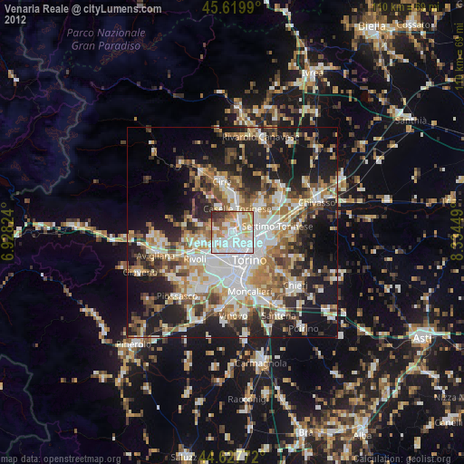
» Earth at Night: Flat Maps 2012, 2016