Urbania night lights from space
Night Light of Urbania (The Marches) from space (Italy) Src. Average luminocity for 10x10km area is 4.8045% and for 50x50km: 6.0609%.
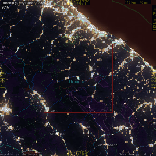
Analysis of Urbania night lights 2016
Square area 10x10 km:
 0.91%
0.91%90-99
0.3%80-89
0.76%70-79
1.06%60-69
0.45%50-59
0.15%40-49
0.45%30-39
0.15%20-29
1.21%10-19
0.61%0-9
93.94%Square area 50x50 km:
0.64%90-99
1.05%80-89
0.57%70-79
0.38%60-69
0.51%50-59
0.83%40-49
1.09%30-39
0.81%20-29
1.88%10-19
4.43%0-9
87.81%Clear (daylight) street map image can be seen on geolist.org.
Map coordinates:
44° 10' 29.2" North, 11° 49' 4.1" East
43° 40' 6" North, 12° 31' 15.3" East
43° 9' 27.2" North, 13° 13' 26.6" East
Some cities around Urbania sort by population:
• Fermignano
11.1 km =6.9 mi,  75°
75°
• Fossombrone
23.5 km =14.6 mi, 84°
• Urbino
11.3 km =7 mi,  55°
55°
• Cagli
17.1 km =10.6 mi,  141°
141°
• Fiorentino, SM
27.4 km =17 mi,  349°
349°
• Faetano, SM
29 km =18 mi,  356°
356°
• Poggio di Chiesanuova, SM
27.4 km =17 mi,  343°
343°
• Monte Giardino, SM
26.9 km =16.7 mi, 353°
3165038 (p: 5,499)
Sources (retrieved 2019-11-25):
» Earth at Night: Flat Maps 2012, 2016