Tivoli night lights from space
Night Light of Tivoli (Latium) from space (Italy) Src. Average luminocity for 10x10km area is 45.2492% and for 50x50km: 38.6918%.
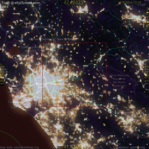
Analysis of Tivoli night lights 2016
Square area 10x10 km:
 4.92%
4.92%90-99
7.62%80-89
6.83%70-79
6.83%60-69
4.76%50-59
5.4%40-49
10.79%30-39
9.52%20-29
18.73%10-19
23.49%0-9
1.11%Square area 50x50 km:
8.26%90-99
8.16%80-89
4.32%70-79
4.97%60-69
4.83%50-59
5.63%40-49
5.45%30-39
5.01%20-29
9.1%10-19
9.01%0-9
35.25%Clear (daylight) street map image can be seen on geolist.org.
Map coordinates:
42° 28' 48.8" North, 12° 5' 54.5" East
41° 57' 34.3" North, 12° 48' 5.8" East
41° 26' 4.3" North, 13° 30' 17" East
Some cities around Tivoli sort by population:
• Guidonia Montecelio
7.6 km =4.7 mi,  300°
300°
• Guidonia
7.8 km =4.8 mi, 298°
• Villanova
3.8 km =2.4 mi,  276°
276°
• Villa Adriana
2.5 km =1.6 mi,  258°
258°
• Bagni di Tivoli
7.1 km =4.4 mi, 261°
• Villalba
6 km =3.7 mi, 263°
• Marcellina
7.2 km =4.5 mi,  1°
1°
• Castel Madama
5.7 km =3.5 mi,  74°
74°
3165624 (p: 22,018)
Sources (retrieved 2019-11-25):
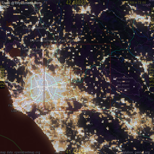
» Earth at Night: Flat Maps 2012, 2016